
6
documented records
≈ 850–1,700
approx. capacity (graves)
0.043 km²
cemetery area
Nov 5, 2026
last modified
About this cemetery
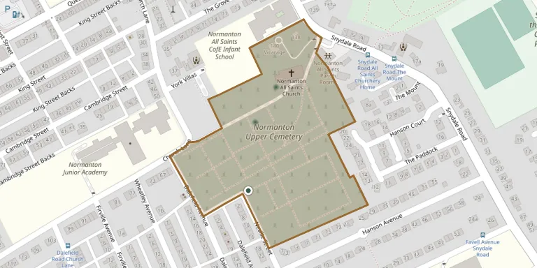
Normanton Upper Cemetery is one of three cemeteries in the Normanton and Altofts area of West Yorkshire. It lies near Normanton Parish Church (All Saints), whose original churchyard has older headstones.
Cemetery location
GPS coordinates: 53.696468° N, 1.415637° W Directions in Google Maps (opens in a new tab)
Memorials
6 memorials, A–Z by surname.
 Ada Green 1879 – 1880
- Joseph Green ? – 1890
- Zillah Green ? – 1882
 Emanuel Woodhead 1804 – 1885
- Mary Woodhead ? – 1891
- William Woodhead ? – 1675
Looking for someone who isn't listed? Request a photo.
Nearby cemeteries
The closest other burial grounds listed on EveryStone.
- All Saints Churchyard 180 m away · Normanton
- Normanton Lower Cemetery 650 m away · Normanton
- Altofts Cemetery 1.9 km away · Altofts · 2 records
- Snydale Cemetery 2.5 km away · Streethouse
- St Peter the Apostle Churchyard 2.9 km away · Warmfield
- St. Peter Churchyard Extension Cemetery 2.9 km away · Warmfield
- Sharlston Cemetery 3.2 km away · Sharlston
- St Luke the Evangelist Churchyard Extension 3.3 km away · Sharlston Common
- Featherstone Cemetery 3.4 km away · Featherstone
- All Saints Churchyard 3.5 km away · Featherstone
Contribute with the app
Our website works smoothly on both desktop and mobile devices. Prefer a native app? Check it out below.
- Capture clear headstone photos
- Save GPS grave locations automatically
- Transcribe inscriptions with our AI
- Suggest corrections to existing records
Common questions
How big is Normanton Upper Cemetery?
Normanton Upper Cemetery covers about 43,000 m² (11 acres), about the size of 6 soccer fields. It is the 23rd largest of the 340 cemeteries we list in West Yorkshire.
What is the oldest grave in this cemetery?
The oldest grave among the records we hold for Normanton Upper Cemetery is that of William Woodhead, who died on August 24, 1675.