
Cemetery #12147
Mesnil Communal Cemetery Extension
Local name: Extension du cimetière communal de Mesnil
0
documented records
≈ 22–45
approx. capacity (graves)
1,110 m²
cemetery area
Oct 18, 2026
last modified
About this cemetery
The extension to the communal cemetery at Mesnil-Martinsart was begun in July 1916. The area stayed close to the Allied front line until September 1916 and again from March to August 1918, and the extension was used again as a front-line cemetery in 1918. It now contains 333 Commonwealth burials and commemorations of the First World War. More about the cemetery can be found through cwgc.org.
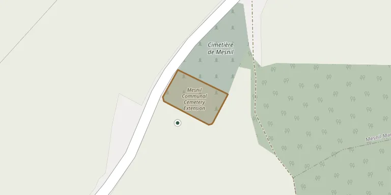
Cemetery location
GPS coordinates: 50.048641° N, 2.642194° E Directions in Google Maps (opens in a new tab)
Memorials
No records yet
Photograph a headstone and add it to the archive.
Looking for someone who isn't listed? Request a photo.
Nearby cemeteries
The closest other burial grounds listed on EveryStone.
- Mesnil Communal Cemetery 70 m away · Mesnil-Martinsart
- Martinsart British Cemetery 1.3 km away · Mesnil-Martinsart · 1 record
- Aveluy Wood Cemetery, (Lancashire Dump), Mesnil-Martinsart 1.4 km away · Mesnil-Martinsart · 1 record
- Authuile Military Cemetery 1.9 km away · Authuille
- Hamel Military Cemetery, Beaumont-Hamel 1.9 km away · Beaumont-Hamel
- Mesnil Ridge Cemetery, Mesnil-Martinsart 2.0 km away · Mesnil-Martinsart
- Authuille Cemetery 2.1 km away · Authuille
- Knightsbridge Cemetery, Mesnil-Martinsart 2.1 km away · Mesnil-Martinsart
- Le Hamel Hamlet Cemetery, Mesnil-Martinsart 2.4 km away · Mesnil-Martinsart
- Blighty Valley Cemetery, Authuille Wood 2.6 km away · Aveluy
Contribute with the app
Our website works smoothly on both desktop and mobile devices. Prefer a native app? Check it out below.
- Capture clear headstone photos
- Save GPS grave locations automatically
- Transcribe inscriptions with our AI
- Suggest corrections to existing records
Common questions
How big is Mesnil Communal Cemetery Extension?
Mesnil Communal Cemetery Extension covers about 1,110 m² (0.3 acres), about the size of 4 tennis courts. It is the 790th smallest of the 4,957 cemeteries we list in Hauts-de-France.