
6
documented records
≈ 380–760
approx. capacity (graves)
0.019 km²
cemetery area
Nov 5, 2026
last modified
About this cemetery
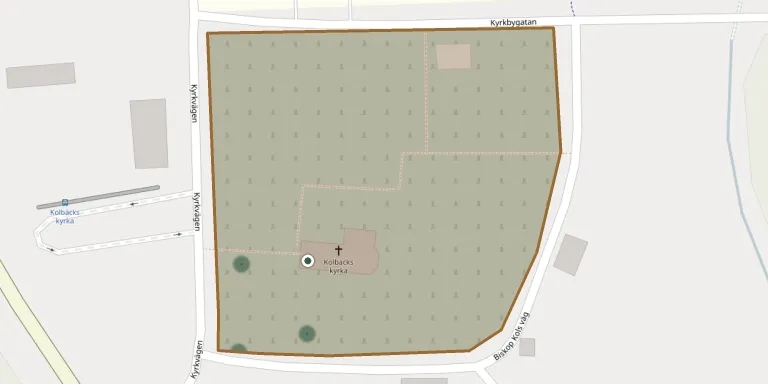
Kolbäcks kyrka lies in Kolbäck, Västmanland, Sweden.
Cemetery location
GPS coordinates: 59.557747° N, 16.227976° E Directions in Google Maps (opens in a new tab)
Memorials
6 memorials, A–Z by surname.
 Oscar Ellert 1895 – 1979
- Hildur Johansson 1896 – 1944
 Elimar Lundh 1910 – 2002
- Hildur Lundh 1913 – 1980
 Ernst Lundin 1888 – 1911
- Hanna Lundin 1861 – 1911
Looking for someone who isn't listed? Request a photo.
Nearby cemeteries
The closest other burial grounds listed on EveryStone.
- Svedvi Churchyard 4.5 km away · Hallstahammar · 3 records
- Säby Churchyard 4.8 km away · Säby
- Munktorp Churchyard 5.6 km away · Munktorp
- Berg Churchyard 5.7 km away · Norrby
- Rytterne Churchyard 9.7 km away · Västerås
- Dingtuna New Cemetery 9.9 km away · Dingtuna
- Dingtuna Old Churchyard 9.9 km away · Dingtuna
- Lillhärads Churchyard 13 km away · Gränsta
- Lillhärads Cemetery 13 km away · Gränsta
- Lundby Churchyard 14 km away · Västerås
Contribute with the app
Our website works smoothly on both desktop and mobile devices. Prefer a native app? Check it out below.
- Capture clear headstone photos
- Save GPS grave locations automatically
- Transcribe inscriptions with our AI
- Suggest corrections to existing records
Common questions
How big is Kolbäcks kyrka?
Kolbäcks kyrka covers about 19,000 m² (4.7 acres), about the size of 3 soccer fields. It is the 14th largest of the 67 cemeteries we list in Västmanland.
What is the oldest grave in this cemetery?
The oldest grave among the records we hold for Kolbäcks kyrka is that of Ernst Lundin, who died in 1911 at the age of 23.