
0
documented records
≈ 4,100–8,100
approx. capacity (graves)
0.203 km²
cemetery area
Oct 18, 2026
last modified
About this cemetery
San José de Flores Cemetery lies in Comuna 7 of Buenos Aires and covers 25 hectares. The first cemetery of the village was opened in 1807 by Ramón Francisco Flores, and in 1832 it was moved to land donated by the family of Esteban Villanueva. It passed to the municipality of San José de Flores in 1865 and was incorporated into the city of Buenos Aires after federalization. The present cemetery was opened on 9 April 1867 and is one of the three cemeteries in the city.
Cemetery location
GPS: GPS coordinates: 34.648250° S, 58.453112° W Directions in Google Maps (opens in a new tab)
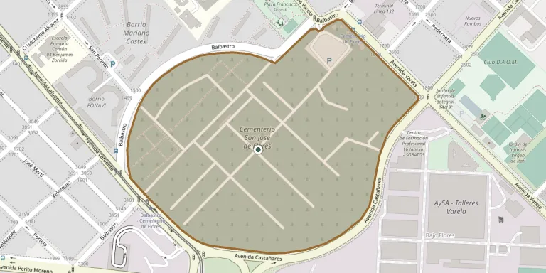
Memorials
No records yet
Photograph a headstone and add it to the archive.
Looking for someone who isn't listed? Request a photo.
Nearby cemeteries
The closest other burial grounds listed on EveryStone.
- Chacarita Cemetery 6.3 km away · Comuna 15
- Británico Cemetery 6.5 km away · Comuna 15
- Aleman Cemetery 6.6 km away · Comuna 15
- Comunitario de Liniers Cemetery 7.4 km away · Tres de Febrero Partido
- Sefaradi De Socorros Mutuos Cemetery 7.7 km away · La Tablada
- Tablada Jewish Cemetery 8.0 km away · La Tablada
- La Tablada Cemetery 8.2 km away · La Tablada
- Recoleta Cemetery 8.7 km away · Recoleta
- Bene Emeth Sephardic Jewish Cemetery, Lomas de Zamora 9.0 km away · Banfield
- Israelita Sefarardí Cemetery 9.2 km away · Tres de Febrero Partido
Contribute with the app
Our website works smoothly on both desktop and mobile devices. Prefer a native app? Check it out below.
- Capture clear headstone photos
- Save GPS grave locations automatically
- Transcribe inscriptions with our AI
- Suggest corrections to existing records
Common questions
How big is San José de Flores Cemetery?
San José de Flores Cemetery covers about 20.3 hectares (203,000 m²), about the same size as Bellu Cemetery in Bucharest. It is the 2nd largest of the 5 cemeteries we list in Ciudad Autónoma de Buenos Aires.