
Cemetery #168397
Riverstone Cemetery
0
documented records
≈ 930–1,900
approx. capacity (graves)
0.046 km²
cemetery area
Oct 18, 2026
last modified
About this cemetery
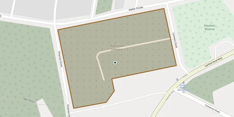
Riverstone Cemetery was reserved and planned in 1892 and opened for interments in 1894, serving the growing rural community of Riverstone. It is a traditional rural cemetery of monumental graves set among stands of gum trees, with a columbarium. It is operated by Blacktown City Council and is bounded by Penprase Street, Walker Parade, Cemetery Road and Garfield Road West. To learn more, visit blacktown.nsw.gov.au.
Cemetery location
GPS coordinates: 33.685410° S, 150.847820° E Directions in Google Maps (opens in a new tab)
Memorials
No records yet
Photograph a headstone and add it to the archive.
Looking for someone who isn't listed? Request a photo.
Nearby cemeteries
The closest other burial grounds listed on EveryStone.
- St Phillip's Anglican Church (Clydesdale Estate) Cemetery 3.0 km away · Angus
- Rouse Hill Anglican Cemetery 6.4 km away · Sydney
- Castlebrook Memorial Park Cemetery and Crematorium 7.0 km away · Kellyville Ridge
- McGraths Hill Cemetery 8.0 km away · McGraths Hill
- Windsor South Cemetery 8.7 km away · Sydney
- St Matthews Anglican Church and 1810 Graveyard 9.1 km away · Windsor
- Pitt Town (Saint James) Anglican Cemetery 11 km away · Pitt Town
- Pitt Town Cemetery 11 km away · Pitt Town
- St Marys General Cemetery (Sydney, New South Wales) 11 km away · St Marys
- St Mary Magdalene Anglican Church Graveyard 11 km away · St Marys
Contribute with the app
Our website works smoothly on both desktop and mobile devices. Prefer a native app? Check it out below.
- Capture clear headstone photos
- Save GPS grave locations automatically
- Transcribe inscriptions with our AI
- Suggest corrections to existing records
Common questions
How big is Riverstone Cemetery?
Riverstone Cemetery covers about 46,000 m² (11 acres), about the size of 7 soccer fields. It is the 181st largest of the 1,091 cemeteries we list in New South Wales.