
Cemetery #171669
Ruden Cemetery
Local name: Friedhof Ruden
Also known as Pfarrkirche Ruden
11
documented records
≈ 54–110
approx. capacity (graves)
2,720 m²
cemetery area
Nov 5, 2026
last modified
About this cemetery
The cemetery is in the municipality of Ruden, Völkermarkt district, Carinthia, and the municipality is responsible for administering its cemeteries and mortuary halls. It includes a chapel with a Crucifixion group, and the parish church describes a neo-Gothic wayside shrine set into the southern cemetery wall.
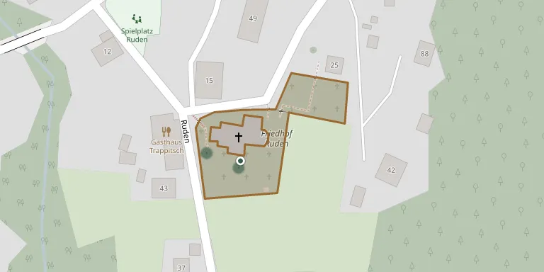
Cemetery location
GPS coordinates: 46.658800° N, 14.773518° E Directions in Google Maps (opens in a new tab)
Memorials
11 memorials, A–Z by surname.
 Karl Furian 1945 – 1985
 Anna Haschei 1951 – 2017
- Herbert Haschei 1953 – 2021
- Georg Jakob 1920 – 1997
- Georg Jakob 1957 – 2022
- Georg Jakob 1889 – 1929
- Katharina Jakob 1927 – 2000
- Antonia Pirker 1892 – 1975
- Engelbert Pirker 1931 – 1962
- Engelbert Pirker 1905 – 1951
- Justine Rupitz 1879 – 1946
Looking for someone who isn't listed? Request a photo.
Nearby cemeteries
The closest other burial grounds listed on EveryStone.
- Ruden Cemetery 2.4 km away · Sankt Nikolai
- St. Radegund Cemetery 3.0 km away · Untermitterdorf
- St. Radegund Churchyard 3.4 km away · Untermitterdorf
- Pfarrkirche Rinkenberg 4.0 km away · Rinkenberg
- Schwabegg Cemetery 5.8 km away · Oberdorf
- Griffen Cemetery 6.3 km away · Griffen · 26 records
- Pfarrkirche St. Peter am Wallersberg 6.3 km away · Sankt Peter am Wallersberg
- Einersdorf/Nonča vas 6.5 km away · Bleiburg · 17 records
- Sankt Martin im Granitztal Parish Church and Cemetery 6.8 km away · Sankt Martin
- Edling / Kazaze Cemetery 6.8 km away · Edling
Contribute with the app
Our website works smoothly on both desktop and mobile devices. Prefer a native app? Check it out below.
- Capture clear headstone photos
- Save GPS grave locations automatically
- Transcribe inscriptions with our AI
- Suggest corrections to existing records
Common questions
How big is Ruden Cemetery?
Ruden Cemetery covers about 2,720 m² (0.7 acres), about the size of 10 tennis courts. It is the 141st largest of the 442 cemeteries we list in Carinthia.
What is the oldest grave in this cemetery?
The oldest grave among the records we hold for Ruden Cemetery is that of Georg Jakob, who died in 1929 at the age of 40.