
Cemetery #174727
Dom Bosco Cemetery, Caieiras
Local name: Cemiterio Dom Bosco
Also known as Cemitério de Perus
0
documented records
≈ 4,500–8,900
approx. capacity (graves)
0.223 km²
cemetery area
Oct 18, 2026
last modified
About this cemetery
The Dom Bosco Cemetery, also known as the Perus Cemetery, was created in 1971 and covers about 254,000 square metres in northern São Paulo, near the border with Caieiras. It has been renamed Colina dos Mártires. In 1990 it drew national attention when the first clandestine mass grave of the Brazilian military dictatorship was found there.
Cemetery location
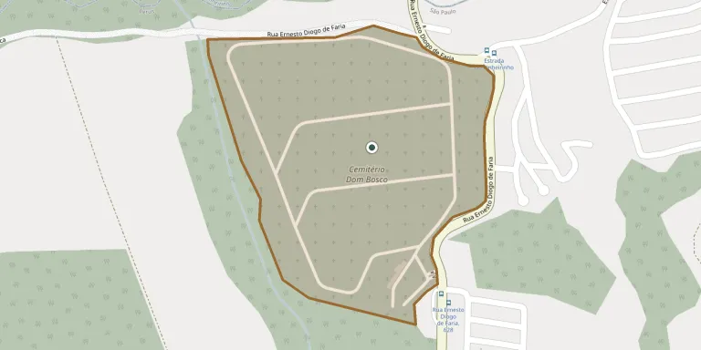
GPS coordinates: 23.392041° S, 46.743269° W Directions in Google Maps (opens in a new tab)
Memorials
No records yet
Photograph a headstone and add it to the archive.
Looking for someone who isn't listed? Request a photo.
Nearby cemeteries
The closest other burial grounds listed on EveryStone.
- Caieiras Cemetery 2.9 km away · Caieiras
- Peace Cemetery, Caieiras 3.5 km away · Caieiras
- Juquery Cemetery, Caieiras 4.8 km away · Caieiras
- Parque Gethsemani Anhaguera Cemetery 6.8 km away · Osasco
- Jaraguá Park Cemetery (São Paulo) 7.1 km away · São Paulo
- Paixão Cemetery 8.2 km away · Franco da Rocha
- Valle das Colinas Cemetery 8.7 km away · Franco da Rocha
- Girassóis Park Cemetery (Osasco) 12 km away · Osasco
- Vila Nova Cachoeirinha Cemetery (São Paulo) 12 km away · São Paulo
- Francisco Morato Municipal Cemetery 13 km away · Francisco Morato
Contribute with the app
Our website works smoothly on both desktop and mobile devices. Prefer a native app? Check it out below.
- Capture clear headstone photos
- Save GPS grave locations automatically
- Transcribe inscriptions with our AI
- Suggest corrections to existing records
Common questions
How big is Dom Bosco Cemetery, Caieiras?
Dom Bosco Cemetery, Caieiras covers about 22.3 hectares (223,000 m²), about the same size as Powązki Military Cemetery in Warsaw. It is the 12th largest of the 978 cemeteries we list in São Paulo.