
Cemetery #17855
Coudekerque-Branche Municipal Cemetery
Local name: Cimetière Municipal de Coudekerque-Branche
Also known as Cimetière de Coudekerque-Branche
17
documented records
≈ 560–1,100
approx. capacity (graves)
0.028 km²
cemetery area
Oct 27, 2026
last modified
About this cemetery
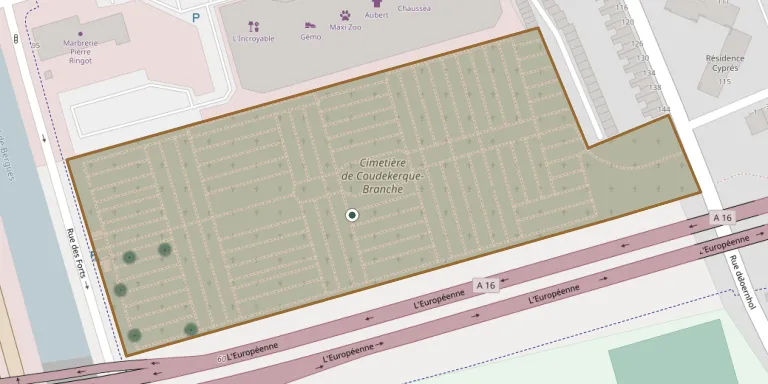
Coudekerque-Branche Municipal Cemetery lies in Hauts-de-France, France.
Cemetery location
GPS: GPS coordinates: 51.014042° N, 2.381509° E Directions in Google Maps (opens in a new tab)
Memorials
17 memorials, A–Z by last name.
 Rosalie Arnouts ? – 1912
- Benoit Blondel 1831 – 1908
- Marie Blondel ? – 1932
- Pierre Blondel ? – 1909
 Blanche Delobel 1880 – 1955
- François Delobel 1851 – 1940
- Laure Delobel ? – 1919
- Camille Dewaele ? – 1925
- Charles Jomier ? – 1907
 Aurélie Monkarey 1881 – 1970
- René Monkarey 1877 – 1960
- Laure Naassens 1879 – 1912
 Numidia Oliveira 1924 – 1999
- Serafim Rocha de Oliveira 1923 – 2005
 Emile Segers 1931 – 1992
- Georgette Segers 1934 – 2006
- Louise Van Belleghem ? – 1910
Looking for someone who isn't listed? Request a photo.
Nearby cemeteries
The closest other burial grounds listed on EveryStone.
- Dunkirk Town Cemetery (Dunkerque Cemetery) 1.7 km away · Dunkirk · 12 records
- Dunkirk Protestant Cemetery 1.8 km away · Dunkirk
- Dunkerque Jewish Cemetery 1.8 km away · Dunkirk
- Dunkerque National Cemetery 1.8 km away · Dunkerque (Dunkirk)
- Dunkirk Town Cemetery 1.9 km away · Dunkirk
- Cappelle-la-Grande Cemetery 2.4 km away · Cappelle-la-Grande
- Coudekerque-Village Cemetery 3.3 km away · Coudekerque-Village
- La Branche Intercommunal Cemetery, Téteghem 3.4 km away · Téteghem
- Saint-Pol-sur-Mer Cemetery 3.7 km away · Saint-Pol-sur-Mer
- Malo-les-Bains Communal Cemetery 3.7 km away · Malo-les-Bains
Contribute with the app
Our website works smoothly on both desktop and mobile devices. Prefer a native app? Check it out below.
- Capture clear headstone photos
- Save GPS grave locations automatically
- Transcribe inscriptions with our AI
- Suggest corrections to existing records
Common questions
How big is Coudekerque-Branche Municipal Cemetery?
Coudekerque-Branche Municipal Cemetery covers about 28,000 m² (6.9 acres), about the size of 4 soccer fields. It is the 124th largest of the 4,956 cemeteries we list in Hauts-de-France.
What is the oldest grave in this cemetery?
The oldest grave among the records we hold for Coudekerque-Branche Municipal Cemetery is that of Charles Joseph Jomier, who died on February 22, 1907.