
Cemetery #181739
Telč Jewish Cemetery
Local name: Židovský hřbitov Telč
Also known as Židovský hřbitov v Telči
0
documented records
≈ 54–110
approx. capacity (graves)
2,700 m²
cemetery area
Oct 18, 2026
last modified
About this cemetery
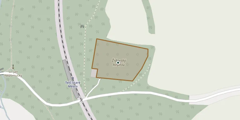
The Jewish cemetery in Telč was established in 1879–1880 on the south-eastern edge of the town, near the Staroměstský pond, and covers about 2,800 square metres. An older Jewish cemetery had disappeared without trace. The site is open only on exceptional occasions.
Cemetery location
GPS coordinates: 49.174619° N, 15.463154° E Directions in Google Maps (opens in a new tab)
Memorials
No records yet
Photograph a headstone and add it to the archive.
Looking for someone who isn't listed? Request a photo.
Nearby cemeteries
The closest other burial grounds listed on EveryStone.
- Telč Our Lady Churchyard 360 m away · Telč · 118 records
- Telč St. Anne Churchyard 1.1 km away · Telč · 553 records
- Telč Cemetery 2.0 km away · Telč · 43 records
- Radkov Cemetery near Telč 3.1 km away · Radkov · 30 records
- Kostelní Myslová Cemetery 4.2 km away · Kostelní Myslová · 73 records
- Myslůvka Jewish Cemetery 5.3 km away · Myslůvka
- Urbanov Cemetery 5.9 km away · Urbanov · 158 records
- Mrákotín Cemetery near Telč 6.6 km away · Mrákotín · 128 records
- Kostelní Vydří Cemetery 7.9 km away · Kostelní Vydří · 27 records
- Nová Říše Cemetery 8.3 km away · Nová Říše · 99 records
Contribute with the app
Our website works smoothly on both desktop and mobile devices. Prefer a native app? Check it out below.
- Capture clear headstone photos
- Save GPS grave locations automatically
- Transcribe inscriptions with our AI
- Suggest corrections to existing records
Common questions
How big is Telč Jewish Cemetery?
Telč Jewish Cemetery covers about 2,700 m² (0.7 acres), about the size of 10 tennis courts. It is the 176th largest of the 374 cemeteries we list in Vysočina Region.