
15
documented records
≈ 530–1,100
approx. capacity (graves)
0.026 km²
cemetery area
Nov 5, 2026
last modified
About this cemetery
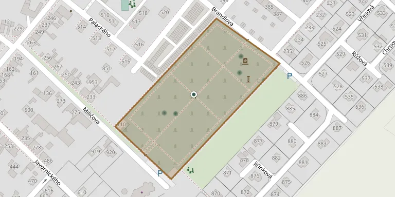
The municipal cemetery of Vysoké Mýto was established around 1893 as a new town cemetery, replacing the older burial ground at the church. It occupies a large rectangular plot on the edge of the town towards Litomyšl, in the Litomyšl Suburb. The cemetery beside the Church of the Holy Trinity was abolished in 1906. Today the town's technical services look after the cemetery.
Cemetery location
GPS coordinates: 49.949439° N, 16.168922° E Directions in Google Maps (opens in a new tab)
Memorials
15 memorials, A–Z by surname.
 Oldřich Bace 1911 – 1987
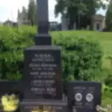 Leopold Beneš 1893 – 1972
- Miroslav Beneš 1929 – 1982
- Dagmar Benešová 1934 – 1991
- Marie Benešová 1902 – 1970
- Růžena Benešová 1895 – 1958
- Hermann Hujer 1911 – 1969
 Wilhelm Kehrer 1906 – 1945
 Marie Košinová 1885 – 1928
 Leopold Lichtenberg 1831 – 1900
- Josefa Lichtenbergová 1834 – 1905
- Věra Malá 1922 – 2014
- Jaroslav Malý 1919 – 2003
- Karel Wipler 1865 – 1930
- Leopoldina Wiplerová 1868 – 1933
Looking for someone who isn't listed? Request a photo.
Nearby cemeteries
The closest other burial grounds listed on EveryStone.
- Knířov Cemetery 3.1 km away · Vysoké Mýto
- Slatina Cemetery 3.6 km away · Slatina · 21 records
- Tisová Vysoké Mýto Cemetery 3.8 km away · Tisová
- Hrušová Cemetery 5.1 km away · Hrušová
- Zámrsk Cemetery 5.5 km away · Zámrsk · 43 records
- Vraclav Cemetery 5.7 km away · Vraclav
- Sruby Cemetery 5.8 km away · Sruby
- Vračovice-Orlov Cemetery 5.9 km away · Vračovice-Orlov · 18 records
- České Heřmanice Cemetery 6.2 km away · České Heřmanice · 47 records
- Bučina Evangelical Cemetery 6.3 km away · Bučina
Contribute with the app
Our website works smoothly on both desktop and mobile devices. Prefer a native app? Check it out below.
- Capture clear headstone photos
- Save GPS grave locations automatically
- Transcribe inscriptions with our AI
- Suggest corrections to existing records
Common questions
How big is Vysoké Mýto Cemetery?
Vysoké Mýto Cemetery covers about 26,000 m² (6.5 acres), about the size of 4 soccer fields. It is the 5th largest of the 393 cemeteries we list in Pardubice Region.
What is the oldest grave in this cemetery?
The oldest grave among the records we hold for Vysoké Mýto Cemetery is that of Leopold Lichtenberg, who died on January 9, 1900 at the age of 68.