
Cemetery #18239
Shrapnel Valley Cemetery
Also known as Şarapnel Vadisi Mezarlığı
0
documented records
≈ 55–110
approx. capacity (graves)
2,750 m²
cemetery area
Oct 18, 2026
last modified
About this cemetery
Shrapnel Valley Cemetery was laid out at the head of Shrapnel Valley on the Gallipoli peninsula, beside a major route up to the Anzac front line. The valley was named by Anzac troops after the Turkish artillery shells that burst overhead. The cemetery contains the graves of 683 Commonwealth soldiers and is known for its distinctive Judas tree.
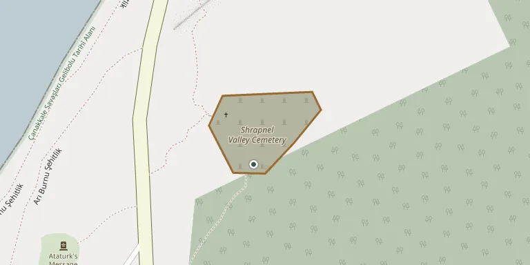
Cemetery location
GPS coordinates: 40.234051° N, 26.278419° E Directions in Google Maps (opens in a new tab)
Memorials
No records yet
Photograph a headstone and add it to the archive.
Looking for someone who isn't listed? Request a photo.
Nearby cemeteries
The closest other burial grounds listed on EveryStone.
- Beach Cemetery 210 m away · Gallipoli
- Plugge's Plateau Cemetery 420 m away · Gallipoli
- Ari Burnu Cemetery 500 m away · Gallipoli
- 4th Battalion Parade Ground Cemetery 660 m away · Gallipoli
- Johnston's Jolly Cemetery 770 m away · Gallipoli
- Lone Pine Cemetery and Memorial 830 m away · Gallipoli
- Kanlı Sırt Cemetery 840 m away · Çanakkale
- Courtney's and Steel's Post Cemetery 910 m away · Gallipoli
- Shell Green Cemetery 930 m away · Gallipoli
- Walker's Ridge Cemetery 1.2 km away · Gallipoli
Contribute with the app
Our website works smoothly on both desktop and mobile devices. Prefer a native app? Check it out below.
- Capture clear headstone photos
- Save GPS grave locations automatically
- Transcribe inscriptions with our AI
- Suggest corrections to existing records
Common questions
How big is Shrapnel Valley Cemetery?
Shrapnel Valley Cemetery covers about 2,750 m² (0.7 acres), about the size of 11 tennis courts. It is the 49th smallest of the 100 cemeteries we list in Çanakkale.