
Cemetery #183342
Strakonice St. Wenceslas Cemetery
Local name: Svatováclavský hřbitov Strakonice
Also known as Svatováclavský hřbitov · St. Wenzel-Friedhof
0
documented records
≈ 560–1,100
approx. capacity (graves)
0.028 km²
cemetery area
Oct 18, 2026
last modified
About this cemetery
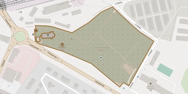
The St Wenceslas cemetery is the main municipal cemetery of Strakonice, on the southeastern edge of town. It surrounds the church of St Wenceslas on the site of the vanished settlement of Lom and dates from the turn of the 13th and 14th centuries. It took its present form in three stages and became the only cemetery in Strakonice.
Cemetery location
GPS: 49.253596° N, 13.917595° E Directions in Google Maps (opens in a new tab)
Memorials
No records yet
Photograph a headstone and add it to the archive.
Looking for someone who isn't listed? Request a photo.
Nearby cemeteries
The closest other burial grounds listed on EveryStone.
- Podsrp Strakonice Cemetery 1.8 km away · Strakonice
- Strakonice Jewish Cemetery 2.7 km away · Strakonice
- Řepice Cemetery 3.2 km away · Řepice · 6 records
- Jinín Cemetery 5.5 km away · Jinín
- Jinín Cemetery 6.0 km away · Jinín
- Hoštice Jewish Cemetery 6.2 km away · Hoštice
- St. Nicholas Churchyard, Štěkeň 6.3 km away · Štěkeň
- Hoštice Cemetery 6.6 km away · Hoštice
- Osek Jewish Cemetery 6.9 km away · Osek
- Radomyšl Cemetery 6.9 km away · Kaletice
Contribute with the app
Our website works smoothly on both desktop and mobile devices. Prefer a native app? Check it out below.
- Capture clear headstone photos
- Save GPS grave locations automatically
- Transcribe inscriptions with our AI
- Suggest corrections to existing records
Common questions
How big is Strakonice St. Wenceslas Cemetery?
Strakonice St. Wenceslas Cemetery covers about 28,000 m² (6.9 acres), about the size of 4 soccer fields. It is the 7th largest of the 395 cemeteries we list in South Bohemian Region.