
Cemetery #185646
Rauhannummi Cemetery
Local name: Rauhannummen hautausmaa
Also known as Rauhannummi · Rauhanummen hautausmaa
0
documented records
≈ 850–1,700
approx. capacity (graves)
0.043 km²
cemetery area
Oct 18, 2026
last modified
About this cemetery
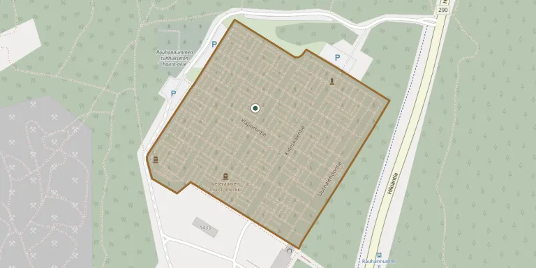
Rauhannummi Cemetery belongs to the Hyvinkää parish and lies on Hikiäntie, near the border with Hausjärvi. The land was acquired in 1965, and the cemetery and its funeral chapel, designed by Aarno Ruusuvuori, were taken into use in 1972. A crematorium followed in 1974 and cremated 26 deceased in its first year.
Cemetery location
GPS: 60.673611° N, 24.894593° E Directions in Google Maps (opens in a new tab)
Memorials
No records yet
Photograph a headstone and add it to the archive.
Looking for someone who isn't listed? Request a photo.
Nearby cemeteries
The closest other burial grounds listed on EveryStone.
- Rauhannummen tunnukseton hauta-alue 110 m away · Hyvinge
- Hyvinkää Railway Workers' Cemetery 4.7 km away · Hyvinkää
- Puolimatka Cemetery 6.8 km away · Hyvinkää · 91 records
- Riihimäki Heroes' Cemetery 10.0 km away · Riihimäki · 9 records
- Riihimäki Parish Cemetery 10 km away · Riihimäki · 399 records
- Punavankileirin 1918 hauta-alue 11 km away · Riihimäki
- Hausjärvi Cemetery 11 km away · Hausjärvi · 60 records
- Kirkonkylä Heroes' Cemetery 11 km away · Kirkonkylä
- Kytäjä Cemetery 14 km away · Hyvinkää
- Jokela Urn Grove 15 km away · Jokela
Contribute with the app
Our website works smoothly on both desktop and mobile devices. Prefer a native app? Check it out below.
- Capture clear headstone photos
- Save GPS grave locations automatically
- Transcribe inscriptions with our AI
- Suggest corrections to existing records
Common questions
How big is Rauhannummi Cemetery?
Rauhannummi Cemetery covers about 43,000 m² (11 acres), about the size of 6 soccer fields. It is the 4th largest of the 41 cemeteries we list in Kanta-Häme.