
Cemetery #185767
Henin Communal Cemetery Extension
Local name: Cimetière communal de Henin, extension
Also known as Henin Communal Cemetery CWGC Extension
1
documented record
≈ 20–40
approx. capacity (graves)
1,010 m²
cemetery area
Oct 18, 2026
last modified
About this cemetery
The extension to the communal cemetery at Hénin-sur-Cojeul was made between April and November 1917, chiefly by the 21st and 30th Divisions. Fifteen further burials were made at a later date. The village had been in German hands since August 1914 and became a no-man's-land after the Germans evacuated its inhabitants in March 1917. The extension holds around 176 First World War burials and commemorations. More about the cemetery can be found through ww1cemeteries.com.
Cemetery location
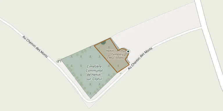
GPS: GPS coordinates: 50.218140° N, 2.838825° E Directions in Google Maps (opens in a new tab)
Memorials
1 memorial, A–Z by surname.

Looking for someone who isn't listed? Request a photo.
Nearby cemeteries
The closest other burial grounds listed on EveryStone.
- Henin-sur-Cojeul 80 m away · Hénin-sur-Cojeul · 12 records
- Henin Crucifix CWGC Cemetery 1.1 km away · Hénin-sur-Cojeul
- St Martin Calvaire British Cemetery, St Martin-sur-Cojeul 1.4 km away · Saint-Martin-sur-Cojeul
- Saint-Martin-sur-Cojeul 1.4 km away · Saint-Martin-sur-Cojeul · 4 records
- Cojeul British Cemetery 1.5 km away · Saint-Martin-sur-Cojeul
- Summit Trench Cemetery 1.8 km away · Croisilles
- Boyelles Cemetery 2.1 km away · Boyelles
- Boyelles Communal Cemetery Extension 2.1 km away · Boyelles · 4 records
- Neuville-Vitasse Road Cemetery 2.2 km away · Neuville-Vitasse
- Boiry-Becquerelle Cemetery 2.3 km away · Boiry-Becquerelle
Contribute with the app
Our website works smoothly on both desktop and mobile devices. Prefer a native app? Check it out below.
- Capture clear headstone photos
- Save GPS grave locations automatically
- Transcribe inscriptions with our AI
- Suggest corrections to existing records
Common questions
How big is Henin Communal Cemetery Extension?
Henin Communal Cemetery Extension covers about 1,010 m² (0.3 acres), about the size of 4 tennis courts. It is the 684th smallest of the 4,957 cemeteries we list in Hauts-de-France.
What is the oldest grave in this cemetery?
The oldest grave among the records we hold for Henin Communal Cemetery Extension is that of Frederick Lawson, who died on August 26, 1917 at the age of 24.