
Cemetery #186282
Caours Cemetery
Local name: Cimetière de Caours
Also known as Cimetière de l'église de Caours
0
documented records
≈ 45–90
approx. capacity (graves)
2,240 m²
cemetery area
Oct 18, 2026
last modified
About this cemetery
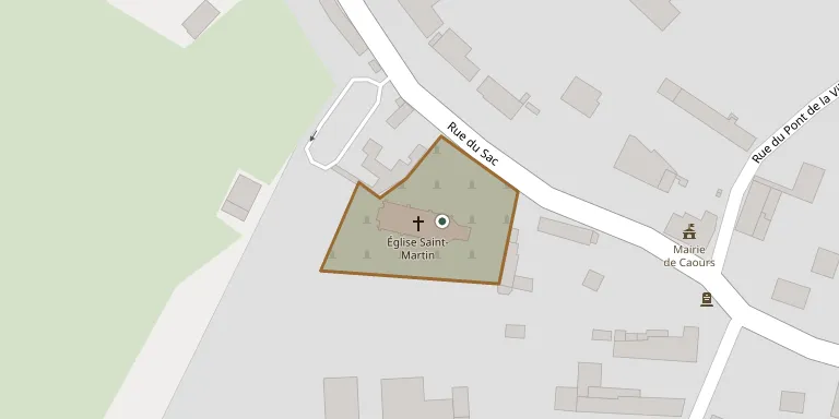
The communal cemetery of Caours stands around the parish church in the centre of the village and can be entered by three different gates.
Cemetery location
GPS coordinates: 50.129793° N, 1.880795° E Directions in Google Maps (opens in a new tab)
Memorials
No records yet
Photograph a headstone and add it to the archive.
Looking for someone who isn't listed? Request a photo.
Nearby cemeteries
The closest other burial grounds listed on EveryStone.
- L'Heure Churchyard 810 m away · Caours
- Drucat Cemetery 2.3 km away · Drucat
- Neufmoulin Cemetery 2.3 km away · Neufmoulin
- Vauchelles Cemetery 2.6 km away · Vauchelles-les-Quesnoy
- Millencourt-en-Ponthieu 2.8 km away · Millencourt-en-Ponthieu
- Abbeville Communal Cemetery Extension 3.5 km away · Abbeville
- La Chapelle Cemetery French Military Plot, Thuison 3.6 km away · Thuison
- Abbeville Communal Cemetery 3.6 km away · Abbeville
- Saint Riquier British Cemetery 4.2 km away · Saint-Riquier
- Bellancourt Cemetery 4.3 km away · Buigny-l'Abbé
Contribute with the app
Our website works smoothly on both desktop and mobile devices. Prefer a native app? Check it out below.
- Capture clear headstone photos
- Save GPS grave locations automatically
- Transcribe inscriptions with our AI
- Suggest corrections to existing records
Common questions
How big is Caours Cemetery?
Caours Cemetery covers about 2,240 m² (0.6 acres), about the size of 9 tennis courts. It is the 2,113th smallest of the 4,957 cemeteries we list in Hauts-de-France.