
Cemetery #186866
Kirchheimbolanden Jewish Cemetery
Local name: Judischer Friedhof Kirchheimbolanden
Also known as Jüdischer Friedhof, Haide
3
documented records
≈ 55–110
approx. capacity (graves)
2,760 m²
cemetery area
Nov 5, 2026
last modified
About this cemetery
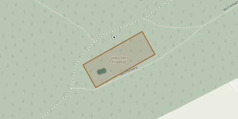
The Jewish cemetery of Kirchheimbolanden covers 4,260 square metres and lies about 1.5 kilometres west of the town, in the woods of the Judental. It was probably laid out before 1782 and enlarged in 1845, and burials continued until 1939. A Jewish burial ground may already have existed in the 17th century.
Cemetery location
GPS coordinates: 49.665519° N, 7.991632° E Directions in Google Maps (opens in a new tab)
Memorials
3 memorials, A–Z by surname.


Looking for someone who isn't listed? Request a photo.
Nearby cemeteries
The closest other burial grounds listed on EveryStone.
- FriedWald Kirchheimbolanden 1.5 km away · Kirchheimbolanden
- Bischheim Cemetery 2.8 km away · Bischheim
- Bolanden Cemetery 2.8 km away · Bolanden
- Bennhausen Cemetery 4.8 km away · Bennhausen
- Marnheim Cemetery 4.8 km away · Marnheim
- Marnheim Cemetery 4.9 km away · Marnheim
- RuheForst Vorholz 4.9 km away · Orbis
- Dannenfels Cemetery 5.2 km away · Dannenfels
- Dannenfels Old Cemetery 5.5 km away · Dannenfels
- Beth ha Kwaroth Cemetery (House of Eternity), Weitersweiler 5.7 km away · Weitersweiler
Contribute with the app
Our website works smoothly on both desktop and mobile devices. Prefer a native app? Check it out below.
- Capture clear headstone photos
- Save GPS grave locations automatically
- Transcribe inscriptions with our AI
- Suggest corrections to existing records
Common questions
How big is Kirchheimbolanden Jewish Cemetery?
Kirchheimbolanden Jewish Cemetery covers about 2,760 m² (0.7 acres), about the size of 11 tennis courts. It is the 1,274th smallest of the 3,001 cemeteries we list in Rhineland-Palatinate.
What is the oldest grave in this cemetery?
The oldest grave among the records we hold for Kirchheimbolanden Jewish Cemetery is that of Johannette Goldmann, who died on February 22, 1902 at the age of 79.