
Cemetery #188849
Quetzaltenango General Cemetery
Local name: Cementerio General Quetzaltenango
0
documented records
≈ 4,300–8,600
approx. capacity (graves)
0.214 km²
cemetery area
Oct 18, 2026
last modified
About this cemetery
The General Cemetery of Quetzaltenango is described as a place of historical and cultural importance that spans three centuries. It contains marble mausoleums and colourfully painted graves packed closely together. Local press has reported on its neglect and deterioration in recent years.
Cemetery location
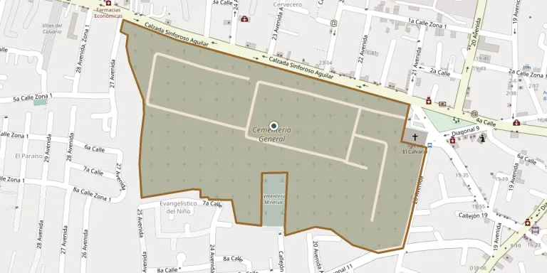
GPS coordinates: 14.836673° N, 91.528915° W Directions in Google Maps (opens in a new tab)
Memorials
No records yet
Photograph a headstone and add it to the archive.
Looking for someone who isn't listed? Request a photo.
Nearby cemeteries
The closest other burial grounds listed on EveryStone.
- Las Cumbres Private Garden Cemetery 2.6 km away · Quetzaltenango
- Almolonga Cemetery 4.1 km away · Almolonga
- La Esperanza General Cemetery 6.4 km away · Quetzaltenango
- San Mateo Cemetery 7.5 km away · San Mateo
- Cantel Municipal Cemetery 8.2 km away · Cantel
- Salcajá Cemetery 8.4 km away · Salcajá
- San Andres Cemetery 8.9 km away · San Andrés Xecul
- San Francisco La Unión Municipal Cemetery 10 km away · Quetzaltenango
- El Calvario General Cemetery 11 km away · Concepción Chiquirichapa
- San Juan Ostuncalco Cemetery 11 km away · San Juan Ostuncalco
Contribute with the app
Our website works smoothly on both desktop and mobile devices. Prefer a native app? Check it out below.
- Capture clear headstone photos
- Save GPS grave locations automatically
- Transcribe inscriptions with our AI
- Suggest corrections to existing records
Common questions
How big is Quetzaltenango General Cemetery?
Quetzaltenango General Cemetery covers about 21.4 hectares (214,000 m²), about the same size as Bellu Cemetery in Bucharest. It is the largest of the 30 cemeteries we list in Quetzaltenango.