
0
documented records
≈ 340–680
approx. capacity (graves)
0.017 km²
cemetery area
Oct 18, 2026
last modified
About this cemetery
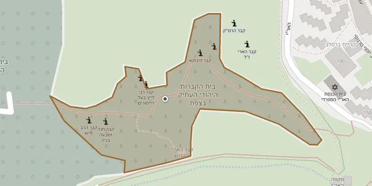
The old Jewish cemetery of Safed is among the oldest cemeteries in the Land of Israel, lying on the western slope of the city at the end of Ha-Ari Street, below Mount Canaan and facing the Sea of Galilee. It has served the town for many centuries, and the graves of Isaac Luria (the Ari) and Joseph Karo are here. More than 700,000 people are said to visit each year. A newer cemetery was opened in 1963 at its foot.
Cemetery location
GPS coordinates: 32.968044° N, 35.488620° E Directions in Google Maps (opens in a new tab)
Memorials
No records yet
Photograph a headstone and add it to the archive.
Looking for someone who isn't listed? Request a photo.
Nearby cemeteries
The closest other burial grounds listed on EveryStone.
- Safed New Cemetery 140 m away · Zefat
- Safed Military Cemetery 260 m away · Zefat
- Biriya Cemetery 1.3 km away · Birya
- Rosh Pina Cemetery 4.1 km away · Rosh Pina
- Hatzor HaGlilit Cemetery 4.5 km away · Hatzor HaGlilit
- Rosh Pinna Military Cemetery 4.7 km away · Rosh Pina
- Meron Cemetery 4.9 km away · Merom HaGalil Regional Council
- Amirim Cemetery 5.4 km away · Amirim
- Dalton Cemetery 6.1 km away · Dalton
- Elifelet Cemetery 6.1 km away · Elifelet
Contribute with the app
Our website works smoothly on both desktop and mobile devices. Prefer a native app? Check it out below.
- Capture clear headstone photos
- Save GPS grave locations automatically
- Transcribe inscriptions with our AI
- Suggest corrections to existing records
Common questions
How big is Safed Old Cemetery?
Safed Old Cemetery covers about 17,000 m² (4.2 acres), about the size of 2 soccer fields. It is the 25th largest of the 201 cemeteries we list in North District.