
Cemetery #193671
Symonds Street Cemetery
0
documented records
≈ 1,200–2,400
approx. capacity (graves)
0.061 km²
cemetery area
Oct 18, 2026
last modified
About this cemetery
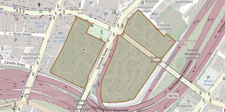
Symonds Street Cemetery is a historic cemetery and park in central Auckland, also called Grafton Cemetery. It covers 5.8 hectares of deciduous forest on the western slope of Grafton Gully, at the corner of Symonds Street and Karangahape Road, and is crossed by Grafton Bridge. It took burials from 1841, was the city's main burial ground, and no longer accepts burials. It is named after the army officer William Cornwallis Symonds.
Cemetery location
GPS coordinates: 36.858992° S, 174.762415° E Directions in Google Maps (opens in a new tab)
Memorials
No records yet
Photograph a headstone and add it to the archive.
Looking for someone who isn't listed? Request a photo.
Nearby cemeteries
The closest other burial grounds listed on EveryStone.
- Saint Stephen's Anglican Chapel Cemetery, Parnell 2.6 km away · Point Resolution
- St Luke's Anglican Churchyard, Mt Albert 3.7 km away · Mt Albert
- St Andrews Anglican Churchyard, Epsom 3.9 km away · Auckland
- Mount Victoria Cemetery 4.8 km away · Devonport
- Okahu Bay Cemetery 5.0 km away
- O'Neill's Point Cemetery 5.5 km away · Auckland
- Purewa Cemetery and Crematorium, Meadowbank 6.0 km away · Meadowbank
- Pompallier Cemetery, Glenfield 7.0 km away · Auckland
- St Peter's Anglican Churchyard, Onehunga 7.4 km away · Onehunga
- St Ninian's Church & Churchyard 7.4 km away · New Lynn
Contribute with the app
Our website works smoothly on both desktop and mobile devices. Prefer a native app? Check it out below.
- Capture clear headstone photos
- Save GPS grave locations automatically
- Transcribe inscriptions with our AI
- Suggest corrections to existing records
Common questions
How big is Symonds Street Cemetery?
Symonds Street Cemetery covers about 61,000 m² (15 acres), about the size of 9 soccer fields. It is the 9th largest of the 95 cemeteries we list in Auckland.