
Cemetery #194767
General El Ángel Cemetery
Local name: Cementerio General El Ángel
Also known as Cementerio El Ángel
0
documented records
≈ 6.6k–13k
approx. capacity (graves)
0.328 km²
cemetery area
Oct 18, 2026
last modified
About this cemetery
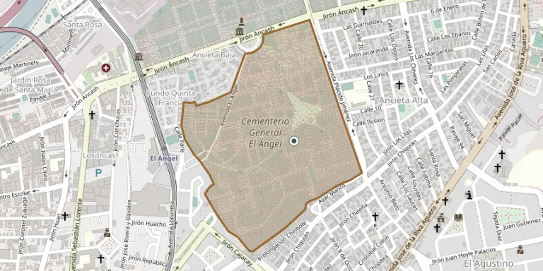
Cementerio El Ángel stands on Jirón Áncash in Barrios Altos, between the districts of Lima and El Agustino. President Manuel Prado Ugarteche inaugurated it on 27 June 1959 because the Presbítero Matías Maestro cemetery was nearly full. It occupies about 29 hectares and belongs to the Beneficencia de Lima.
Cemetery location
GPS coordinates: 12.045843° S, 77.005346° W Directions in Google Maps (opens in a new tab)
Memorials
No records yet
Photograph a headstone and add it to the archive.
Looking for someone who isn't listed? Request a photo.
Nearby cemeteries
The closest other burial grounds listed on EveryStone.
- El Agustino Cemetery 560 m away · El Agustino
- Presbítero Matías Maestro Cemetery 610 m away · Lima
- Padre Eterno Cemetery 990 m away · El Agustino
- El Sauce Cemetery 5.0 km away · San Juan de Lurigancho
- Santa Rosa Private Cemetery 5.1 km away · San Juan de Lurigancho
- Surquillo Municipal Cemetery 7.6 km away · Surquillo
- Campo Fe De Huachipa 8.6 km away · Huachipa
- La Planicie Cemetery, La Molina 8.6 km away · La Molina
- Huachipa Cemetery 8.8 km away · Santa Anita - Los Ficus
- La Planicie Cemetery - Crypt of the Resurrection 9.1 km away · La Molina
Contribute with the app
Our website works smoothly on both desktop and mobile devices. Prefer a native app? Check it out below.
- Capture clear headstone photos
- Save GPS grave locations automatically
- Transcribe inscriptions with our AI
- Suggest corrections to existing records
Common questions
How big is General El Ángel Cemetery?
General El Ángel Cemetery covers about 32.8 hectares (328,000 m²), about the same size as Rakowicki Cemetery in Kraków. It is the 4th largest of the 118 cemeteries we list in Lima.