
83
documented records
≈ 210–420
approx. capacity (graves)
0.010 km²
cemetery area
Nov 5, 2026
last modified
About this cemetery
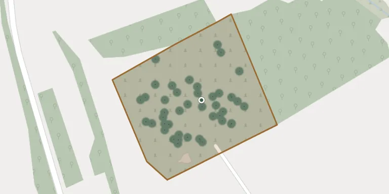
The parish cemetery in Lubla, in the Frysztak municipality, belongs to the parish of St. Nicholas and covers 1.967 hectares. Lubla lies along the road between Frysztak and Jasło.
Cemetery location
GPS coordinates: 49.806359° N, 21.585103° E Directions in Google Maps (opens in a new tab)
Memorials
Showing the first 50 of 83, A–Z by surname. Search all records
 Wanda Adamska 1932 – 2023
- Andrzej Adamski 1930 – 2010
 Tadeusz Betlej 1942 – 1990
- Władysława Betlej 1945 – 2022
 Emilia Bicos 1909 – 1994
- Jan Bigos 1915 – 2003
 Franciszek Byk 1891 – 1960
 Jan Byk 1923 – 1957
- Stanisław Byk 1928 – 1962
- Stefania Byk 1902 – 1969
- Wiktorja Byk 1890 – 1948
- Wojciech Byk 1883 – 1952
 Antoni Czerniccy 1899 – 1973
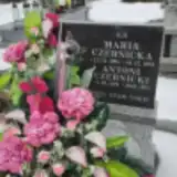 Maria Czernicka 1905 – 1981
- Michalina Czernicka 1905 – 1938
 Wiktoria Czernicka 1898 – 1978
- Antoni Czernicki 1899 – 1951
 Józef Dąbek 1922 – 1989
 Bronisława Dętkoś 1933 – 2015
- Ferdynand Dętkoś 1927 – 2003
 Helena Dętkoś 1904 – 1987
- Jan Dętkoś 1904 – 1970
 Wojciech Dominik 1884 – 1948
- Zofia Dulska 1908 – 1995
- Władysław Dulski 1904 – 1945
 Katarzyna Dunaj 1885 – 1958
- Walenty Dunaj 1890 – 1967
 Cecylia Garnczarska 1930 – 2022
- Franciszek Garnczarski 1924 – 2024
- Wiesława Gaweł 1950 – 1951
 Jakub Giera 1897 – 1970
 Józefa Głód 1910 – 1997
- Monika Klisiewicz 1988 – 1989
 Zofia Kłoskowicz 1947 – 2020
 Emilia Knap 1921 – 2016
 Józef Koś 1951 – 2019
- Zbigniew Koś 1966 – 2022
 Helena Kosiba 1927 – 2012
- Władysław Kosiba 1920 – 2013
 Maria Kuliga 1906 – 1961
 Franciszek Lipski 1867 – 1949
 Jan Machnik 1930 – 2023
- Katarzyna Machnik ? – 1972
- Władysław Machnik 1904 – 1969
- Daniela Machoś 1895 – 1965
- Wojciech Machoś 1888 – 1943
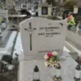 Jan Majchrowicz 1874 – 1952
- Maria Majchrowicz 1879 – 1959
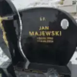 Jan Majewski 1950 – 2024
 Katarzyna Mijal 1905 – 1981
Looking for someone who isn't listed? Request a photo.
Nearby cemeteries
The closest other burial grounds listed on EveryStone.
- Sieklówka War Cemetery No. 42 3.1 km away · Sieklówka Górna
- Glinik Dolny New Jewish Cemetery 3.2 km away · Glinik Dolny
- Glinik Dolny Old Jewish Cemetery 3.5 km away · Glinik Dolny
- Frysztak Municipal Cemetery 3.8 km away · Frysztak
- Bierówka War Cemetery No. 20 3.8 km away · Bierówka
- Jasło World War II Cemetery 4.2 km away · Jasło
- Szebnie Soviet Prisoner-of-War Cemetery 4.8 km away · Bierówka
- Przybówka Parish Cemetery 4.9 km away · Przybówka
- Szebnie Municipal Cemetery 4.9 km away · Szebnie
- Warzyce War Cemetery No. 21 5.1 km away · Warzyce
Contribute with the app
Our website works smoothly on both desktop and mobile devices. Prefer a native app? Check it out below.
- Capture clear headstone photos
- Save GPS grave locations automatically
- Transcribe inscriptions with our AI
- Suggest corrections to existing records
Common questions
How big is Lubla Cemetery?
Lubla Cemetery covers about 10,000 m² (2.6 acres), about the size of a soccer field. It is the 354th largest of the 1,346 cemeteries we list in Subcarpathian Voivodeship.
What is the oldest grave in this cemetery?
The oldest grave among the records we hold for Lubla Cemetery is that of Michalina Czernicka, who died on December 6, 1938 at the age of 33.