
Cemetery #20286
Ancona War Cemetery
Local name: Cimitero di guerra di Ancona
0
documented records
≈ 180–360
approx. capacity (graves)
8,950 m²
cemetery area
Oct 18, 2026
last modified
About this cemetery
The war cemetery lies in the rural locality of Tavernelle, in the commune of Ancona, 3 kilometres south of the town. It reflects the Allied advance up the Adriatic coast in August and September 1944. It holds the graves of Commonwealth servicemen who died in the Second World War.
Cemetery location
GPS coordinates: 43.587238° N, 13.523460° E Directions in Google Maps (opens in a new tab)
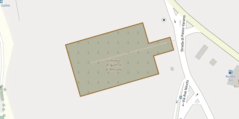
Memorials
No records yet
Photograph a headstone and add it to the archive.
Looking for someone who isn't listed? Request a photo.
Nearby cemeteries
The closest other burial grounds listed on EveryStone.
- Tavernelle Cemetery 350 m away · Ancona
- Montacuto Cemetery 2.0 km away · Monte Baldino
- Pinocchio Cemetery 2.4 km away · Ancona
- Pietralacroce Cemetery 2.4 km away · Ancona
- Varano Cemetery 3.1 km away · Varano
- Campo degli Ebrei 3.9 km away · Ancona
- Candia Cemetery 4.0 km away · Ancona
- Posatora Cemetery 4.4 km away · Ancona
- Poggio Cemetery 5.3 km away · Poggio
- Sappanico Cemetery 6.2 km away · Sappanico
Contribute with the app
Our website works smoothly on both desktop and mobile devices. Prefer a native app? Check it out below.
- Capture clear headstone photos
- Save GPS grave locations automatically
- Transcribe inscriptions with our AI
- Suggest corrections to existing records
Common questions
How big is Ancona War Cemetery?
Ancona War Cemetery covers about 8,950 m² (2.2 acres), about the size of a soccer field. It is the 87th largest of the 473 cemeteries we list in Marche.