
0
documented records
≈ 4,000–7,900
approx. capacity (graves)
0.198 km²
cemetery area
Oct 18, 2026
last modified
About this cemetery
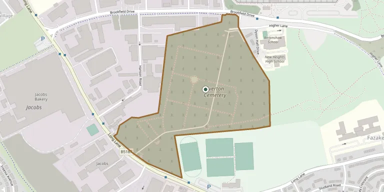
Everton Cemetery is a 55-acre site on Long Lane in north Liverpool, opened for burials in July 1880 after the land was bought in 1876-77. It suffered bomb damage during the Second World War. It contains 55 First World War and 15 Second World War Commonwealth burials, and is run by Liverpool City Council.
Cemetery location
GPS coordinates: 53.457805° N, 2.940110° W Directions in Google Maps (opens in a new tab)
Memorials
No records yet
Photograph a headstone and add it to the archive.
Looking for someone who isn't listed? Request a photo.
Nearby cemeteries
The closest other burial grounds listed on EveryStone.
- Liverpool Cemetery 350 m away · Liverpool
- Walton on the Hill Cemetery 1.3 km away · Walton on the Hill
- Kirkdale Cemetery 1.3 km away · Liverpool · 4 records
- Rice Lane Jewish Cemetery 1.4 km away · Walton on the Hill
- West Derby Cemetery 1.7 km away · Liverpool · 183 records
- West Derby Jewish Cemetery 1.9 km away · Liverpool
- Walton Park Cemetery 2.0 km away · Walton on the Hill · 11 records
- St Mary the Virgin Churchyard 2.2 km away · Walton on the Hill
- St Swithins Churchyard 2.6 km away · Liverpool
- Linacre Lane Cemetery 2.7 km away · Bootle · 2 records
Contribute with the app
Our website works smoothly on both desktop and mobile devices. Prefer a native app? Check it out below.
- Capture clear headstone photos
- Save GPS grave locations automatically
- Transcribe inscriptions with our AI
- Suggest corrections to existing records
Common questions
How big is Everton Cemetery?
Everton Cemetery covers about 19.8 hectares (198,000 m²), a little larger than Brompton Cemetery in London. It is the 6th largest of the 107 cemeteries we list in Merseyside.