
0
documented records
≈ 10k–21k
approx. capacity (graves)
0.518 km²
cemetery area · 128.1 acres
Oct 18, 2026
last modified
About this cemetery
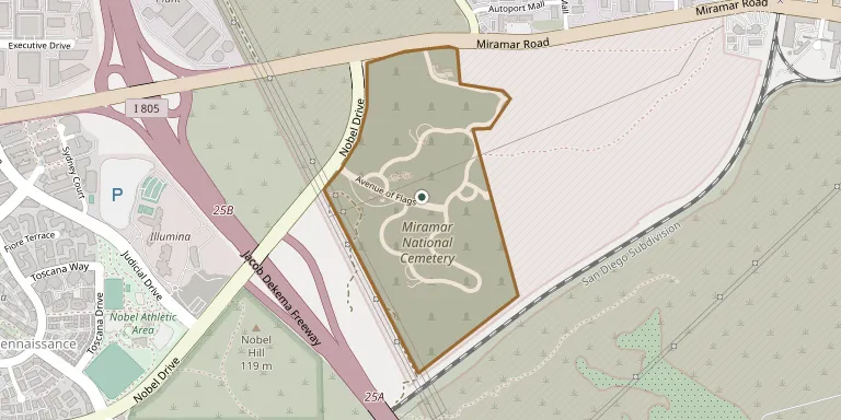
Miramar National Cemetery is a federal military cemetery in San Diego, California, administered by the U.S. Department of Veterans Affairs. It was established in 2010 and covers 313 acres in the northwest corner of Marine Corps Air Station Miramar, on the grounds of former Camp Kearny (1917) and Camp Elliott (1942). It is considered an auxiliary of Fort Rosecrans National Cemetery.
Cemetery location
GPS: GPS coordinates: 32.871729° N, 117.188422° W Directions in Google Maps (opens in a new tab)
Memorials
No records yet
Photograph a headstone and add it to the archive.
Looking for someone who isn't listed? Request a photo.
Nearby cemeteries
The closest other burial grounds listed on EveryStone.
- El Camino Memorial Park 2.6 km away · San Diego
- Carmel Valley Cemetery 8.3 km away · San Diego
- El Campo Santo Catholic Cemetery 13 km away · San Diego
- Olivenhain Cemetery 19 km away · Encinitas
- Dearborn Memorial Park 19 km away · Poway
- Holy Cross Cemetery and Mausoleum 19 km away · San Diego
- Mount Hope Cemetery 19 km away · San Diego
- Home of Peace Cemetery 20 km away · San Diego
- Greenwood Memorial Park 20 km away · San Diego
- Fort Rosecrans National Cemetery 21 km away · San Diego
Contribute with the app
Our website works smoothly on both desktop and mobile devices. Prefer a native app? Check it out below.
- Capture clear headstone photos
- Save GPS grave locations automatically
- Transcribe inscriptions with our AI
- Suggest corrections to existing records
Common questions
How big is Miramar National Cemetery?
Miramar National Cemetery covers about 51.8 hectares (128 acres), about three-quarters the size of Mount Auburn Cemetery in Cambridge, Massachusetts. It is the 24th largest of the 1,272 cemeteries we list in California.