
Cemetery #206271
Tate Township Cemetery
Also known as Bethel Cemetery
0
documented records
≈ 2,800–5,500
approx. capacity (graves)
0.139 km²
cemetery area · 34.3 acres
Oct 1, 2026
last modified
About this cemetery
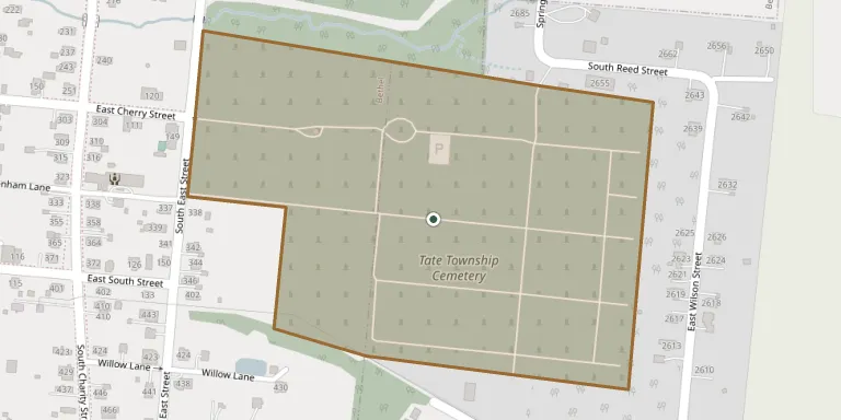
Tate Township Cemetery lies in Bethel, Ohio, United States.
Cemetery location
GPS coordinates: 38.959013° N, 84.074456° W Directions in Google Maps (opens in a new tab)
Memorials
No records yet
Photograph a headstone and add it to the archive.
Looking for someone who isn't listed? Request a photo.
Nearby cemeteries
The closest other burial grounds listed on EveryStone.
- Early Settlers Burying Ground 1.2 km away · Bethel
- Brown Cemetery 3.4 km away · Bethel
- Swing Family Cemetery 3.4 km away · Bethel
- Clover Cemetery 5.3 km away · Williamsburg
- Sugartree Cemetery 5.3 km away · South Bantam
- Brooks Family Cemetery 6.5 km away · Locust Ridge
- Concord Cemetery 7.2 km away · Williamsburg
- Monroe Presbyterian Cemetery 7.8 km away · Nicholsville
- Old Bethel Cemetery 7.8 km away · Bethel
- Hamersville Cemetery 7.9 km away · Hamersville
Contribute with the app
Our website works smoothly on both desktop and mobile devices. Prefer a native app? Check it out below.
- Capture clear headstone photos
- Save GPS grave locations automatically
- Transcribe inscriptions with our AI
- Suggest corrections to existing records
Common questions
How big is Tate Township Cemetery?
Tate Township Cemetery covers about 13.9 hectares (34 acres), about the size of 26 American football fields. It is the 192nd largest of the 6,706 cemeteries we list in Ohio.