
Cemetery #206444
Knollwood Cemetery
Also known as Knollwood Cemetery Association
0
documented records
≈ 6.2k–12k
approx. capacity (graves)
0.311 km²
cemetery area · 76.9 acres
Oct 18, 2026
last modified
About this cemetery
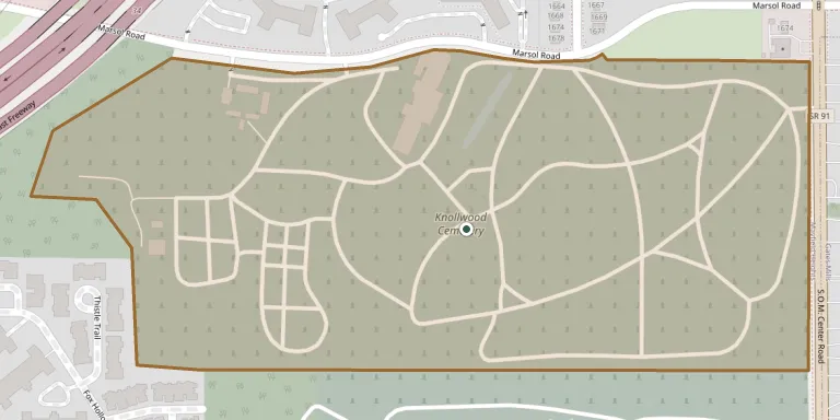
Knollwood Cemetery is at 1678 SOM Center Road in Mayfield Heights, Ohio. Established in 1908, it spans 96 acres of in-ground burial space and has a large mausoleum. It is run by the Knollwood Cemetery Association.
Cemetery location
GPS coordinates: 41.512690° N, 81.443713° W Directions in Google Maps (opens in a new tab)
Memorials
No records yet
Photograph a headstone and add it to the archive.
Looking for someone who isn't listed? Request a photo.
Nearby cemeteries
The closest other burial grounds listed on EveryStone.
- Acacia Masonic Memorial Park 310 m away · Mayfield Heights
- Acacia Park Cemetery 360 m away · Mayfield Heights
- Orange Hill Cemetery 2.4 km away · Pepper Pike
- Mayfield Union Cemetery 2.9 km away · Mayfield
- Gates Mills South Cemetery 3.7 km away · Gates Mills
- Whitehaven Memorial Park 4.1 km away · Mayfield
- Kinsman Road Cemetery 5.6 km away · Pepper Pike
- Orange Cemetery 5.8 km away · Pepper Pike
- Jackson Family Plot 5.8 km away · Pepper Pike
- Mount Sinai Cemetery 6.3 km away · Mayfield
Contribute with the app
Our website works smoothly on both desktop and mobile devices. Prefer a native app? Check it out below.
- Capture clear headstone photos
- Save GPS grave locations automatically
- Transcribe inscriptions with our AI
- Suggest corrections to existing records
Common questions
How big is Knollwood Cemetery?
Knollwood Cemetery covers about 31.1 hectares (77 acres), about the same size as Rakowicki Cemetery in Kraków. It is the 51st largest of the 6,706 cemeteries we list in Ohio.