
0
documented records
≈ 10k–21k
approx. capacity (graves)
0.519 km²
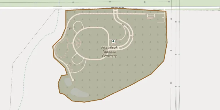
cemetery area · 128.3 acres
Oct 18, 2026
last modified
About this cemetery
Pikes Peak National Cemetery is the third national cemetery established in Colorado and opened in 2018. The Department of Veterans Affairs bought 374 acres in El Paso County in January 2015 for the site, which was once part of the Rolling Hills Ranch. It lies between Bradley and Drennan roads in unincorporated El Paso County, southeast of Colorado Springs.
Cemetery location
GPS: GPS coordinates: 38.778659° N, 104.633539° W Directions in Google Maps (opens in a new tab)
Memorials
No records yet
Photograph a headstone and add it to the archive.
Looking for someone who isn't listed? Request a photo.
Nearby cemeteries
The closest other burial grounds listed on EveryStone.
- Memorial Gardens Cemetery, Colorado Springs 12 km away · Colorado Springs
- Shrine of Remembrance Mausoleum 15 km away · Colorado Springs
- Sons of Israel Cemetery 15 km away · Southeast Colorado Springs Colorado Springs
- Evergreen Cemetery 15 km away · Colorado Springs
- Paupers Cemetery, Colorado Springs 20 km away · Colorado Springs
- Wilson Cemetery 22 km away · Pueblo
- Fairview Cemetery 22 km away · Colorado Springs
- Chico Basin Cemetery 23 km away · Colorado Springs
- Crystal Valley Cemetery 25 km away · Manitou Springs
- Eastonville Cemetery 26 km away · Black Forest
Contribute with the app
Our website works smoothly on both desktop and mobile devices. Prefer a native app? Check it out below.
- Capture clear headstone photos
- Save GPS grave locations automatically
- Transcribe inscriptions with our AI
- Suggest corrections to existing records
Common questions
How big is Pikes Peak National Cemetery?
Pikes Peak National Cemetery covers about 51.9 hectares (128 acres), about three-quarters the size of Mount Auburn Cemetery in Cambridge, Massachusetts. It is the 7th largest of the 689 cemeteries we list in Colorado.