
Cemetery #207032
Lee's Summit Cemetery
Also known as Lee's Summit Historical Cemetery
0
documented records
≈ 1,500–3,000
approx. capacity (graves)
0.075 km²
cemetery area · 18.7 acres
Oct 18, 2026
last modified
About this cemetery
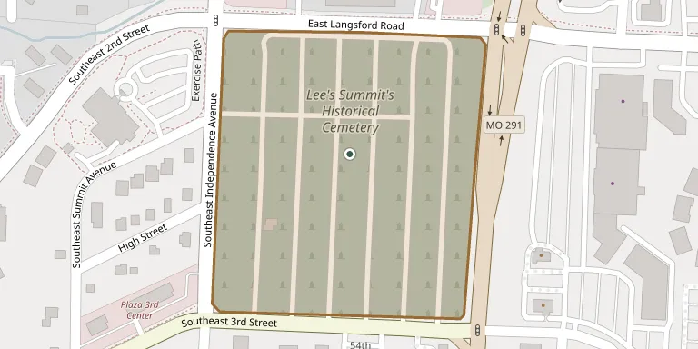
The cemetery in Lee's Summit, Missouri, now known as Lee's Summit Historical Cemetery, was established in 1865 when William Bullitt Howard donated approximately two acres of land. Many notable local people are buried there.
Cemetery location
GPS coordinates: 38.916488° N, 94.363785° W Directions in Google Maps (opens in a new tab)
Memorials
No records yet
Photograph a headstone and add it to the archive.
Looking for someone who isn't listed? Request a photo.
Nearby cemeteries
The closest other burial grounds listed on EveryStone.
- Greenwood Cemetery 6.0 km away · Lee's Summit
- Floral Hills East Memorial Gardens 6.6 km away · Prairie Township
- Howard Cemetery 7.3 km away · Lee's Summit
- Woods Chapel Cemetery 7.4 km away · Prairie Township
- Flanery - Frost Cemetery 7.9 km away · Vale
- XII Gates Memorial Gardens 10 km away · Washington Township
- Noland Cemetery 11 km away · Kansas City
- Mid-America Muslim Cemetery 11 km away · Kansas City
- Stanley Cemetery 11 km away · Blue Springs
- Alley Cemetery 12 km away · Grain Valley
Contribute with the app
Our website works smoothly on both desktop and mobile devices. Prefer a native app? Check it out below.
- Capture clear headstone photos
- Save GPS grave locations automatically
- Transcribe inscriptions with our AI
- Suggest corrections to existing records
Common questions
How big is Lee's Summit Cemetery?
Lee's Summit Cemetery covers about 75,000 m² (19 acres), about the size of 14 American football fields. It is the 215th largest of the 5,368 cemeteries we list in Missouri.