
Cemetery #207142
Lone Fir Cemetery
0
documented records
≈ 2,300–4,500
approx. capacity (graves)
0.113 km²
cemetery area · 27.8 acres
Oct 18, 2026
last modified
About this cemetery
Lone Fir Cemetery in southeast Portland, Oregon, is owned and maintained by Metro, the regional government, and is listed on the National Register of Historic Places. It has more than 25,000 burials on over 30 acres. The first burial was in 1846, and the cemetery is said to have been established in 1855. A volunteer friends group has supported it since 2000.
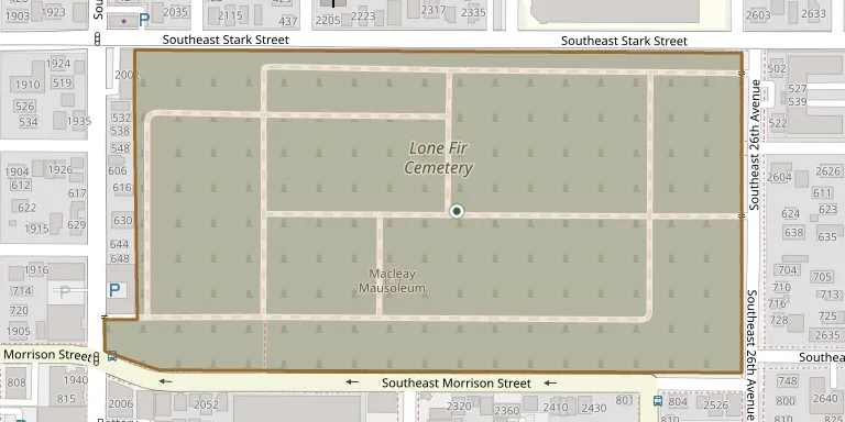
Cemetery location
GPS coordinates: 45.518157° N, 122.642033° W Directions in Google Maps (opens in a new tab)
Memorials
No records yet
Photograph a headstone and add it to the archive.
Looking for someone who isn't listed? Request a photo.
Nearby cemeteries
The closest other burial grounds listed on EveryStone.
- Japanese Ancestral Cemetery 4.3 km away · Portland
- Rose City Cemetery 4.5 km away · Portland
- Brainard Cemetery 5.5 km away · Portland
- Multnomah Park Cemetery 5.8 km away · Portland
- River View Cemetery 6.6 km away · Portland
- Kesser Israel Cemetery 6.9 km away · Southeast Portland Portland
- Congregation Shaarie Torah Cemetery 6.9 km away · Portland
- Beth Israel Cemetery 7.0 km away · Portland
- Grand Army of the Republic Cemetery 7.1 km away · Portland
- Greenwood Hills Cemetery 7.1 km away · Portland
Contribute with the app
Our website works smoothly on both desktop and mobile devices. Prefer a native app? Check it out below.
- Capture clear headstone photos
- Save GPS grave locations automatically
- Transcribe inscriptions with our AI
- Suggest corrections to existing records
Common questions
How big is Lone Fir Cemetery?
Lone Fir Cemetery covers about 11.3 hectares (28 acres), about the size of 21 American football fields. It is the 32nd largest of the 915 cemeteries we list in Oregon.