
Cemetery #208078
Richmond National Cemetery
Also known as Us Veterans Affairs Department
0
documented records
≈ 770–1,500
approx. capacity (graves)
0.039 km²
cemetery area · 9.54 acres
Oct 18, 2026
last modified
About this cemetery
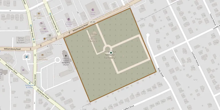
Richmond National Cemetery lies about three miles east of Richmond in Henrico County, Virginia, and covers 9.7 acres. It was opened in 1867, when thousands of Union soldiers were reinterred there from various battlefields. Among the roughly 9,200 early interments are 5,706 unknown Union soldiers. It is administered by the Department of Veterans Affairs, is closed to new interments, and was listed on the National Register of Historic Places in 1995.
Cemetery location
GPS: GPS coordinates: 37.514439° N, 77.392776° W Directions in Google Maps (opens in a new tab)
Memorials
No records yet
Photograph a headstone and add it to the archive.
Looking for someone who isn't listed? Request a photo.
Nearby cemeteries
The closest other burial grounds listed on EveryStone.
- Sir Moses Montefiore Cemetery 1.2 km away · Richmond
- Evergreen Cemetery 2.2 km away · Richmond
- Colored Paupers Cemetery, Richmond 2.5 km away · Richmond
- East End Cemetery 2.5 km away · Montrose
- Shed Town M Street Cemetery 2.6 km away · Shed Town
- Oakwood Cemetery 2.7 km away · Richmond
- St. John's Episcopal Church Cemetery 3.0 km away · Richmond
- Hebrew Cemetery, Richmond 5.3 km away · Richmond
- Shockoe Hill Cemetery 5.4 km away · Richmond
- Maury and Mt. Olivet Cemeteries 5.5 km away · Richmond
Contribute with the app
Our website works smoothly on both desktop and mobile devices. Prefer a native app? Check it out below.
- Capture clear headstone photos
- Save GPS grave locations automatically
- Transcribe inscriptions with our AI
- Suggest corrections to existing records
Common questions
How big is Richmond National Cemetery?
Richmond National Cemetery covers about 39,000 m² (9.5 acres), about the size of 7 American football fields. It is the 253rd largest of the 5,446 cemeteries we list in Virginia.