
Cemetery #211715
Gresham Pioneer and Escobar Cemetery
Also known as Escobar Cemetery · Gresham Pioneer Cemetery
0
documented records
≈ 160–320
approx. capacity (graves)
7,890 m²
cemetery area · 1.95 acres
Oct 18, 2026
last modified
About this cemetery
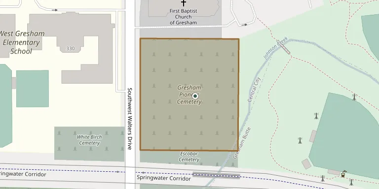
Gresham Pioneer Cemetery in Gresham, Oregon, lies on Southwest Walters Road; sources date its founding to 1851 on land owned by I. I. and Sarah Moore, or to 1859. The adjoining Escobar Cemetery was established in 1914 and is named after Frank Escobar. Multnomah County acquired it in 1957.
Cemetery location
GPS coordinates: 45.496256° N, 122.433891° W Directions in Google Maps (opens in a new tab)
Memorials
No records yet
Photograph a headstone and add it to the archive.
Looking for someone who isn't listed? Request a photo.
Nearby cemeteries
The closest other burial grounds listed on EveryStone.
- White Birch Cemetery 100 m away · Gresham
- Forest Lawn Cemetery 270 m away · Gresham
- Saint Joseph Cemetery 2.2 km away · Gresham
- Mountain View Stark Pioneer Cemetery 4.0 km away · Troutdale
- Douglass Cemetery 5.2 km away · Troutdale
- Deardorff Cemetery 8.2 km away · Happy Valley
- Pleasant Home Cemetery 8.4 km away · Gresham
- Willamette National Cemetery 9.0 km away · Portland
- Damascus Pioneer Cemetery 9.3 km away · Damascus
- Lincoln Memorial Park Cemetery 9.9 km away · Portland
Contribute with the app
Our website works smoothly on both desktop and mobile devices. Prefer a native app? Check it out below.
- Capture clear headstone photos
- Save GPS grave locations automatically
- Transcribe inscriptions with our AI
- Suggest corrections to existing records
Common questions
How big is Gresham Pioneer and Escobar Cemetery?
Gresham Pioneer and Escobar Cemetery covers about 7,890 m² (2 acres), about the size of an American football field. It is the 423rd smallest of the 915 cemeteries we list in Oregon.