
Cemetery #215716
Machpelah Cemetery
0
documented records
≈ 1,100–2,300
approx. capacity (graves)
0.057 km²
cemetery area · 14.2 acres
Oct 18, 2026
last modified
About this cemetery
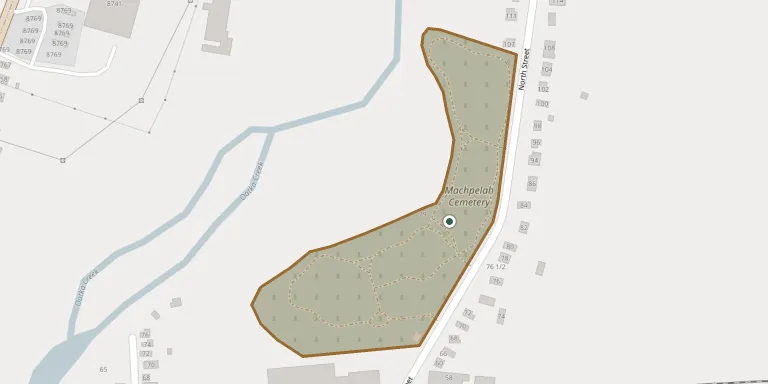
Machpelah Cemetery in Le Roy, New York, is a historic mid-19th-century rural cemetery on the banks of the Oatka. Its development had two phases: it kept its rural-cemetery character until the end of the 19th century, and changed after the Woodward Mausoleum was built in the early 20th century. It is managed by the Machpelah Cemetery Association and contains graves of Revolutionary War veterans.
Cemetery location
GPS coordinates: 42.986653° N, 77.982849° W Directions in Google Maps (opens in a new tab)
Memorials
No records yet
Photograph a headstone and add it to the archive.
Looking for someone who isn't listed? Request a photo.
Nearby cemeteries
The closest other burial grounds listed on EveryStone.
- Old Saint Mark Cemetery 810 m away · Le Roy
- Myrtle Street Cemetery 1.7 km away · Le Roy
- Saint Francis Cemetery 2.0 km away · Le Roy
- E Main Street Cemetery, Le Roy 2.9 km away · Le Roy
- Langworthy Cemetery 3.3 km away · Le Roy
- Jug City Cemetery 4.6 km away · Le Roy
- Thwing Road Cemeter 5.2 km away · Le Roy Le Roy
- Randall Cemetery 5.6 km away · Le Roy
- Stone Church Rural Cemetery 7.0 km away · Stone Church
- Stafford Rural Cemetery 7.5 km away · Stafford
Contribute with the app
Our website works smoothly on both desktop and mobile devices. Prefer a native app? Check it out below.
- Capture clear headstone photos
- Save GPS grave locations automatically
- Transcribe inscriptions with our AI
- Suggest corrections to existing records
Common questions
How big is Machpelah Cemetery?
Machpelah Cemetery covers about 57,000 m² (14 acres), about the size of 11 American football fields. It is the 502nd largest of the 4,596 cemeteries we list in New York.