
Cemetery #219367
Calvary Cemetery
0
documented records
≈ 2,200–4,400
approx. capacity (graves)
0.111 km²
cemetery area · 27.4 acres
Oct 1, 2026
last modified
About this cemetery
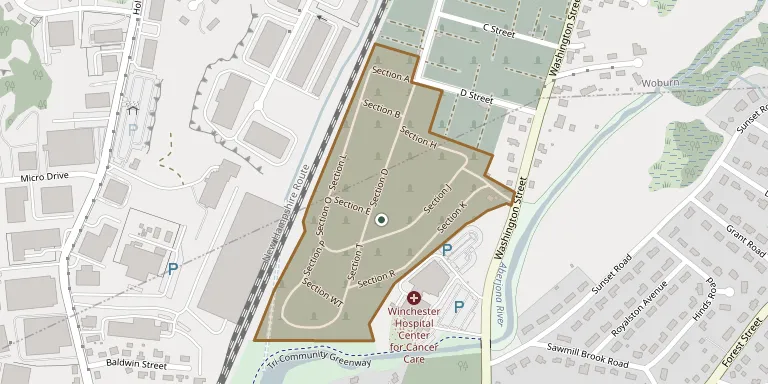
Calvary Cemetery lies in Woburn, Massachusetts, United States.
Cemetery location
GPS coordinates: 42.471467° N, 71.127282° W Directions in Google Maps (opens in a new tab)
Memorials
No records yet
Photograph a headstone and add it to the archive.
Looking for someone who isn't listed? Request a photo.
Nearby cemeteries
The closest other burial grounds listed on EveryStone.
- Kenesseth Israel Cemetery 220 m away · Woburn
- Chevra Kadusha of Boston Cemetery 270 m away · Montvale
- Puritan Mount Sinai Cemetery 280 m away · Montvale
- Roxbury Mutual Cemetery 280 m away · Woburn
- Beth Jacob Cemetery 310 m away · Woburn
- South Boston Lodge Cemetery 320 m away · Woburn
- Congregation Anshi Poland Cemetery 330 m away · Woburn
- Ohel Jacob Cemetery 360 m away · Montvale
- Shomrei Shabos Agudath 360 m away · Woburn
- Pride of Boston Cemetery 380 m away · Montvale
Contribute with the app
Our website works smoothly on both desktop and mobile devices. Prefer a native app? Check it out below.
- Capture clear headstone photos
- Save GPS grave locations automatically
- Transcribe inscriptions with our AI
- Suggest corrections to existing records
Common questions
How big is Calvary Cemetery?
Calvary Cemetery covers about 11.1 hectares (27 acres), about the size of 21 American football fields. It is the 158th largest of the 1,885 cemeteries we list in Massachusetts.