
Cemetery #219898
Mt. Zion Cemetery
Also known as Mount Zion Cemetery
0
documented records
≈ 180–370
approx. capacity (graves)
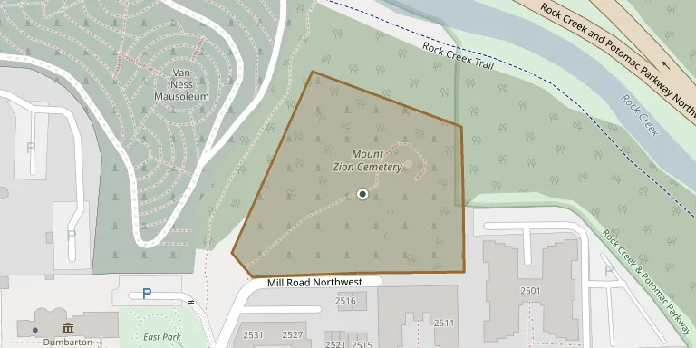
9,210 m²
cemetery area · 2.28 acres
Oct 18, 2026
last modified
About this cemetery
Mount Zion Cemetery in Georgetown, Washington, D.C., began as the Old Methodist Burying Ground, dated to 1808 by the National Park Service and to 1809 by another source. It is named for Mount Zion United Methodist Church, the city's oldest Black congregation. The adjacent Female Union Band Society Cemetery came over time to be called collectively Mount Zion Cemetery.
Cemetery location
GPS coordinates: 38.911456° N, 77.054024° W Directions in Google Maps (opens in a new tab)
Memorials
No records yet
Photograph a headstone and add it to the archive.
Looking for someone who isn't listed? Request a photo.
Nearby cemeteries
The closest other burial grounds listed on EveryStone.
- Oak Hill Cemetery 320 m away · Washington DC
- Holy Rood Cemetery 1.6 km away · Washington
- Georgetown Visitation Monastery Cemetery 1.6 km away · Washington
- Georgetown University Jesuit Cemetery 1.7 km away · Washington
- Arlington National Cemetery 3.7 km away · Arlington
- Prospect Hill Cemetery 4.1 km away · Washington
- Saint Mary Catholic Cemetery 4.3 km away · Washington
- Glenwood Cemetery 4.4 km away · Washington
- Eldbrooke Methodist Cemetery 4.8 km away · Washington
- United States Soldiers' and Airmen's Home National Cemetery 5.4 km away · Washington
Contribute with the app
Our website works smoothly on both desktop and mobile devices. Prefer a native app? Check it out below.
- Capture clear headstone photos
- Save GPS grave locations automatically
- Transcribe inscriptions with our AI
- Suggest corrections to existing records
Common questions
How big is Mt. Zion Cemetery?
Mt. Zion Cemetery covers about 9,210 m² (2.3 acres), about the size of 2 American football fields. It is the 6th smallest of the 23 cemeteries we list in District of Columbia.