
Cemetery #221217
Enid Cemetery
0
documented records
≈ 3,900–7,800
approx. capacity (graves)
0.194 km²
cemetery area · 47.9 acres
Oct 18, 2026
last modified
About this cemetery
Enid Cemetery in Enid, Oklahoma, was established in 1897 and is managed by the Enid Cemetery Association, a non-profit organization. Together with the Calvary Catholic Cemetery, it has been listed on the National Register of Historic Places since 1996. Both were designed in the rural cemetery style.
Cemetery location
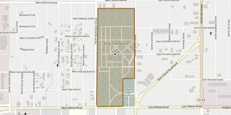
GPS coordinates: 36.423607° N, 97.880173° W Directions in Google Maps (opens in a new tab)
Memorials
No records yet
Photograph a headstone and add it to the archive.
Looking for someone who isn't listed? Request a photo.
Nearby cemeteries
The closest other burial grounds listed on EveryStone.
- Calvary Catholic Cemetery 300 m away · Enid
- Enid State School Cemetery 4.0 km away · Enid
- Memorial Park Cemetery, North Enid 4.0 km away · North Enid
- Mennonite Brethren Cemetery, Enid 4.8 km away · Enid
- Bethany Cemetery 9.2 km away · Enid
- Breckinridge Lutheran Cemetery 13 km away · Breckenridge
- Trinity Lutheran Cemetery 14 km away · Lahoma
- Zion Lutheran Cemetery 15 km away · Fairmont
- Rose Hill Cemetery 15 km away · Enid
- Kremlin Cemetery 15 km away · Kremlin
Contribute with the app
Our website works smoothly on both desktop and mobile devices. Prefer a native app? Check it out below.
- Capture clear headstone photos
- Save GPS grave locations automatically
- Transcribe inscriptions with our AI
- Suggest corrections to existing records
Common questions
How big is Enid Cemetery?
Enid Cemetery covers about 19.4 hectares (48 acres), about the same size as Assistens Cemetery in Copenhagen. It is the 42nd largest of the 2,711 cemeteries we list in Oklahoma.