
Cemetery #22220
Rutherglen Cemetery
77
documented records
≈ 1,500–3,000
approx. capacity (graves)
0.075 km²
cemetery area
Nov 5, 2026
last modified
About this cemetery
Rutherglen Cemetery in South Lanarkshire opened in 1881 and holds records from that date. It continues to be used for burials and the interment of cremations, and contains about 15,000 burials. It is managed by South Lanarkshire Council.
Cemetery location
GPS coordinates: 55.818100° N, 4.214300° W Directions in Google Maps (opens in a new tab)

Memorials
Showing the first 50 of 77, A–Z by surname. Search all records
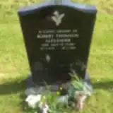 Robert Alexander 1913 – 2007
 Jane Allardyce ? – 1936
- Jeanie Allardyce ? – 1939
- John Allardyce 1877 – 1952
 Duncan Anderson 1848 – 1938
 Margaret Arbuckle 1836 – 1895
 Mary Baird ? – 1947
- Samuel Batson ? – 1935
- Samuel Batson 1946 – 1947
 Margaret Bisset 1882 – 1972
 Alexander Bodie 1893 – 1965
- Mary Bodie ? – 1972
- William Bodie ? – 1931
- Jane Brown ? – 1919
 William Cahey 1877 – 1947
 Margaret Caldow 1875 – 1940
 Isabella Caldwell 1883 – 1957
 Davina Callaghan 1924 – 1989
 Agnes Cameron 1914 – 1988
- David Cameron 1905 – 1986
- Hugh Cameron 1849 – 1910
- Jessie Cameron 1868 – 1937
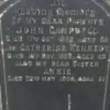 Annie Campbell ? – 1909
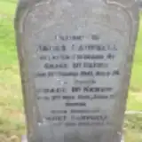 James Campbell 1865 – 1941
- Janet Campbell ? – 1960
- John Campbell 1854 – 1922
 James Clarke ? – 1942
- Jane Clarke 1854 – 1932
- William Clarke 1886 – 1936
- William Clarke 1855 – 1924
 Agnes Clydesdale 1900 – 1975
- John Clydesdale ? – 1966
- Thomas Clydesdale ? – 1909
 Jeanie Connell 1888 – 1961
- Rebecca Connell 1890 – 1980
 James Conroy 1953 – 2001
 Thomas Cooper 1838 – 1897
 Mary Cowan 1908 – 1944
- Isabella Crawford 1880 – 1956
 Jane Crowe 1850 – 1903
 Isabella Cullen 1884 – 1959
 Margaret Cullen 1860 – 1933
 James Cumming 1907 – 1952
 Eliza Cunningham 1857 – 1927
 Joan Cunningham 1942 – 2010
- John Cunningham 1854 – 1924
- Margaret Cunningham 1887 – 1977
- Paddy Cunningham 1947 – 2012
- Richard Cunningham 1881 – 1964
 James Currie ? – 1942
Looking for someone who isn't listed? Request a photo.
Nearby cemeteries
The closest other burial grounds listed on EveryStone.
- Rutherglen Old Parish Cemetery 1.2 km away · Rutherglen · 2 records
- Cathcart Old Parish Church 2.5 km away · Cathcart
- Saint Peter Cemetery Dalbeth 3.0 km away · Glasgow · 211 records
- Cambuslang Churchyard 3.2 km away · Cambuslang
- Linn Cemetery Extension 3.3 km away · Carmunnock
- Cathcart Cemetery 3.4 km away · Cathcart · 35 records
- Linn Cemetery (Muslim Section) 3.4 km away · Glasgow
- Linn Cemetery (New Extension) 3.5 km away · Glasgow
- Southern Necropolis 3.5 km away · Glasgow
- Linn Cemetery 3.6 km away · Glasgow · 74 records
Contribute with the app
Our website works smoothly on both desktop and mobile devices. Prefer a native app? Check it out below.
- Capture clear headstone photos
- Save GPS grave locations automatically
- Transcribe inscriptions with our AI
- Suggest corrections to existing records
Common questions
How big is Rutherglen Cemetery?
Rutherglen Cemetery covers about 75,000 m² (18 acres), about the size of 10 soccer fields. It is the largest of the 51 cemeteries we list in South Lanarkshire.
What is the oldest grave in this cemetery?
The oldest grave among the records we hold for Rutherglen Cemetery is that of Margaret Pollock, who died on January 20, 1840.