
Cemetery #224985
Montgomery Cemetery
0
documented records
≈ 2,000–4,000
approx. capacity (graves)
0.100 km²
cemetery area · 24.8 acres
Oct 18, 2026
last modified
About this cemetery
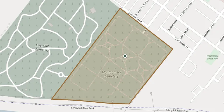
Montgomery Cemetery lies on sloped land along the Schuylkill River just outside Norristown, Pennsylvania, designed in a formal rural landscape style. Founded in 1847 as the first public, non-sectarian burial ground in Montgomery County, its company was incorporated by the Pennsylvania General Assembly on April 10, 1848. It is the final resting place of a number of Civil War soldiers, including five generals.
Cemetery location
GPS: GPS coordinates: 40.119170° N, 75.364985° W Directions in Google Maps (opens in a new tab)
Memorials
No records yet
Photograph a headstone and add it to the archive.
Looking for someone who isn't listed? Request a photo.
Nearby cemeteries
The closest other burial grounds listed on EveryStone.
- Riverside Cemetery 330 m away · Eagleville
- Union Chapel Graveyard 1.2 km away · Abrahams
- Jeffersonville Presbyterian Church Cemetery 1.6 km away · West Norriton
- Saint John Episcopal Church Cemetery 2.0 km away · Norristown
- Roberts Cemetery 2.7 km away · Candle Brook
- Saint Augustine Cemetery 3.0 km away · King of Prussia
- Treemount Cemetery 3.1 km away · Treemont Terrace
- Norris City Cemetery 3.5 km away · East Norriton
- Christ Church Upper Merion Episcopal Cemetery 3.7 km away · Conshohocken
- Saints Peter and Paul Ukrainian Catholic Cemetery 3.8 km away · Upper Merion Township · 102 records
Contribute with the app
Our website works smoothly on both desktop and mobile devices. Prefer a native app? Check it out below.
- Capture clear headstone photos
- Save GPS grave locations automatically
- Transcribe inscriptions with our AI
- Suggest corrections to existing records
Common questions
How big is Montgomery Cemetery?
Montgomery Cemetery covers about 10 hectares (25 acres), about the size of 19 American football fields. It is the 274th largest of the 5,267 cemeteries we list in Pennsylvania.