
Cemetery #22782
Wimborne Road Cemetery
Also known as Wimborne Road Cemetery, Bournemouth
5
documented records
≈ 1,900–3,800
approx. capacity (graves)
0.095 km²
cemetery area
Nov 5, 2026
last modified
About this cemetery
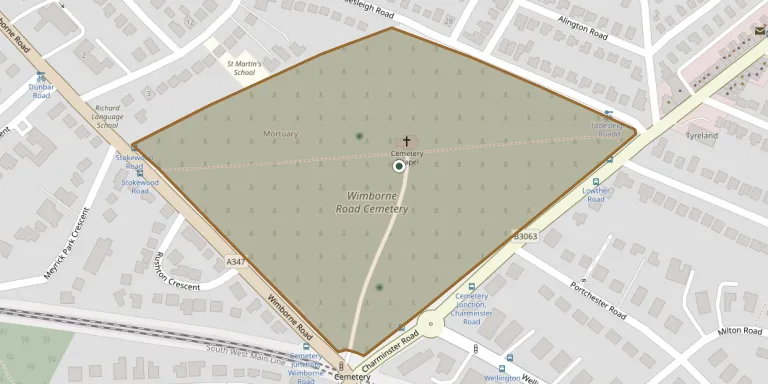
Wimborne Road Cemetery in Bournemouth opened in 1878 and was laid out by the architect Christopher Crabb Creeke. It is Grade II listed by Historic England, and more than 43,000 people have been buried there since the first burial; it remains in use. The cemetery also holds Commonwealth war graves from both world wars.
Cemetery location
GPS coordinates: 50.734001° N, 1.873300° W Directions in Google Maps (opens in a new tab)
Memorials
5 memorials, A–Z by surname.
 Blanche Humphreys 1908 – 1998
- Edward Humphreys 1905 – 1974
 Caroline Pistor 1839 – 1919
- Elizabeth Pistor 1832 – 1918
- Mary Pistor 1829 – 1901
Looking for someone who isn't listed? Request a photo.
Nearby cemeteries
The closest other burial grounds listed on EveryStone.
- Saint Peter Churchyard 1.5 km away · Bournemouth
- St John the Baptist Churchyard 1.8 km away · Bournemouth
- North Cemetery 1.9 km away · Bournemouth
- St. Mark's Churchyard 2.5 km away · Bournemouth · 4 records
- East Cemetery 3.2 km away · Bournemouth · 24 records
- Throop Jewish Cemetery, Bournemouth 3.3 km away · Throop
- Kinson Cemetery 3.7 km away · Bournemouth · 1 record
- All Saints Branksome Park 3.8 km away · Poole St James
- West Parley Cemetery 4.1 km away · West Parley
- St John the Evangelist Churchyard 4.6 km away · Bournemouth
Contribute with the app
Our website works smoothly on both desktop and mobile devices. Prefer a native app? Check it out below.
- Capture clear headstone photos
- Save GPS grave locations automatically
- Transcribe inscriptions with our AI
- Suggest corrections to existing records
Common questions
How big is Wimborne Road Cemetery?
Wimborne Road Cemetery covers about 95,000 m² (23 acres), about the size of 13 soccer fields. It is the 3rd largest of the 273 cemeteries we list in Dorset.
What is the oldest grave in this cemetery?
The oldest grave among the records we hold for Wimborne Road Cemetery is that of Mary Ann Pistor, who died on September 30, 1901 at the age of 72.