
1
documented record
≈ 290–580
approx. capacity (graves)
0.015 km²
cemetery area
Oct 18, 2026
last modified
About this cemetery
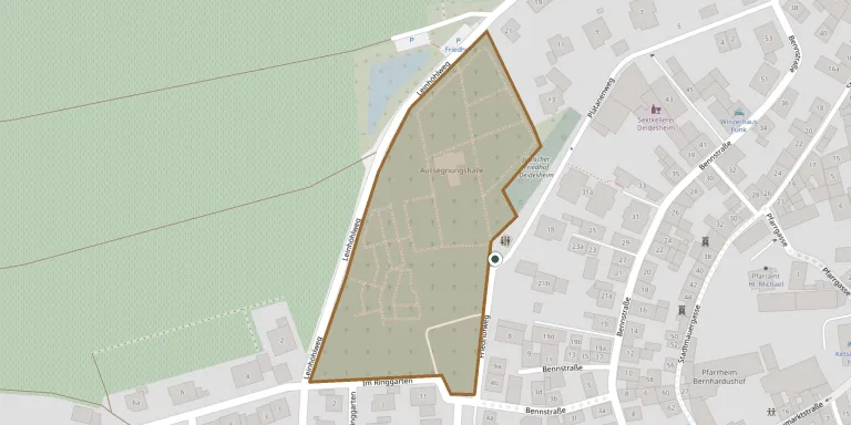
The Jewish community of Deidesheim has had its own cemetery since about 1700, laid out next to the Christian burial ground, and it is first named in documents in 1718. The cemetery lies on Platanenweg and has been a protected monument since 1988. It was desecrated in 1938 and restored in 1946, after the Second World War. More about the cemetery can be found through vg-deidesheim.de.
Cemetery location
GPS coordinates: 49.408298° N, 8.182600° E Directions in Google Maps (opens in a new tab)
Memorials
1 memorial, A–Z by surname.
Looking for someone who isn't listed? Request a photo.
Nearby cemeteries
The closest other burial grounds listed on EveryStone.
- Deidesheim Cemetery 130 m away · Deidesheim
- Ruppertsberg Cemetery 990 m away · Hochdorf-Assenheim
- Forst Cemetery 2.5 km away · Forst
- Niederkirchen Cemetery 2.6 km away · Niederkirchen
- Königsbach Cemetery 2.7 km away · Königsbach
- Wachenheim Jewish Cemetery 3.7 km away · Wachenheim
- Wachenheim Cemetery 3.9 km away · Wachenheim an der Weinstraße
- Gimmeldingen Cemetery 3.9 km away · Gimmeldingen
- Mußbach Cemetery 4.1 km away · Mußbach an der Weinstraße
- Meckenheim Cemetery 4.6 km away · Meckenheim
Contribute with the app
Our website works smoothly on both desktop and mobile devices. Prefer a native app? Check it out below.
- Capture clear headstone photos
- Save GPS grave locations automatically
- Transcribe inscriptions with our AI
- Suggest corrections to existing records
Common questions
How big is Deidesheim Jewish Cemetery?
Deidesheim Jewish Cemetery covers about 15,000 m² (3.6 acres), about the size of 2 soccer fields. It is the 237th largest of the 3,001 cemeteries we list in Rhineland-Palatinate.
What is the oldest grave in this cemetery?
The oldest grave among the records we hold for Deidesheim Jewish Cemetery is that of Julie Wolff, who died in 1880 at the age of 40.