
24
documented records
≈ 130–260
approx. capacity (graves)
6,530 m²
cemetery area
Nov 5, 2026
last modified
About this cemetery
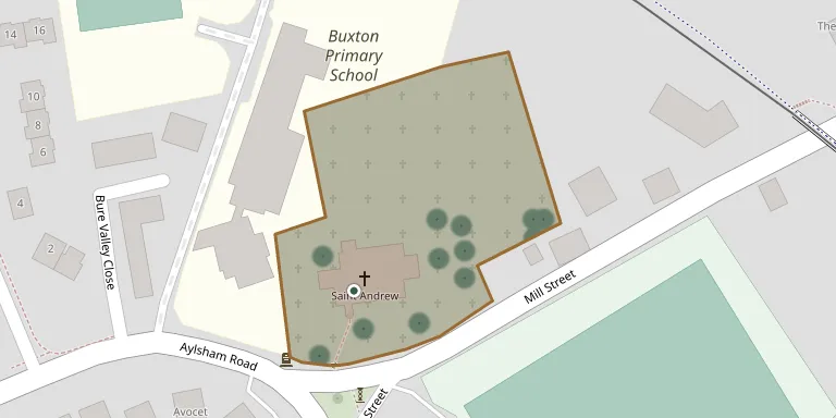
The churchyard surrounds the Church of St Andrew on Mill Street in Buxton, Norfolk. The church is built of flint with limestone dressings and some brick, with a 13th-century chancel and aisles, nave and north chapel from the 14th century. A war memorial stands in the churchyard, and the churchyard is recorded as a site of First World War commemoration.
Cemetery location
GPS coordinates: 52.755737° N, 1.308376° E Directions in Google Maps (opens in a new tab)
Memorials
24 memorials, A–Z by surname.
 John Abigail 1826 – 1893
- Martha Abigail ? – 1912
 Caroline Clarke 1854 – 1925
 Joshua Copland 1811 – 1891
- Joshua Copland ? – 1879
 Alice Daniels 1854 – 1931
 Emily Hardiment 1832 – 1879
 Eleanor Harmer 1854 – 1914
 William Mathews 1709 – 1737
 Edmund Palmer ? – 1836
- Martha Palmer 1810 – 1894
- Martha Palmer ? – 1852
- Philip Palmer ? – 1865
- Philip Palmer ? – 1879
- Sophia Palmer ? – 1866
- William Palmer ? – 1892
 Mabel Potterell 1881 – 1915
 Eliza Smithson 1854 – 1928
- John Smithson ? – 1914
 Phoebe Tallack 1790 – 1868
- William Tallack 1789 – 1867
- Ann Watts ? – 1869
- Thomas Watts ? – 1860
 Marshall Woodcock 1923 – 1927
Looking for someone who isn't listed? Request a photo.
Nearby cemeteries
The closest other burial grounds listed on EveryStone.
- St Andrew's Church Cemetery Extension, Lammas 1.3 km away · Lammas · 1 record
- Lammas, St. Andrew Churchyard 1.3 km away · Lamas · 3 records
- St. Michael & All Angels Churchyard 1.4 km away · Oxnead · 2 records
- St Margarets Church, Stratton Strawless 2.3 km away · Stratton Strawless · 5 records
- St. Peter's Churchyard 2.4 km away · Brampton · 3 records
- St. Mary's Churchyard 2.8 km away · Burgh · 1 record
- All Saints Churchyard (Old Church) 3.1 km away · Hainford
- Norfolk Bluebell Wood Burial Park 3.1 km away · Waterloo
- St Mary The Virgin and St Botolph Churchyard 3.2 km away · Hevingham
- All Saints Church Skeyton 3.3 km away · Skeyton
Contribute with the app
Our website works smoothly on both desktop and mobile devices. Prefer a native app? Check it out below.
- Capture clear headstone photos
- Save GPS grave locations automatically
- Transcribe inscriptions with our AI
- Suggest corrections to existing records
Common questions
How big is St Andrew Churchyard?
St Andrew Churchyard covers about 6,530 m² (1.6 acres), about the size of a soccer field. It is the 152nd largest of the 746 cemeteries we list in Norfolk.
What is the oldest grave in this cemetery?
The oldest grave among the records we hold for St Andrew Churchyard is that of William Mathews, who died on March 22, 1737 at the age of 28.