
0
documented records
≈ 62k–120k
approx. capacity (graves)
3.08 km²
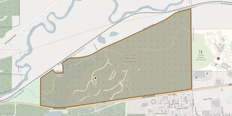
cemetery area · 761.3 acres
Oct 18, 2026
last modified
About this cemetery
Fort Custer National Cemetery is a United States national cemetery just outside the village of Augusta in Kalamazoo County, Michigan. Congress created it in September 1981. The federal cemetery covers about 770 acres on the site of Fort Custer, which was built in 1917 to train soldiers. It includes the burial places of several German prisoners of war from World War II.
Cemetery location
GPS coordinates: 42.338837° N, 85.319949° W Directions in Google Maps (opens in a new tab)
Memorials
No records yet
Photograph a headstone and add it to the archive.
Looking for someone who isn't listed? Request a photo.
Nearby cemeteries
The closest other burial grounds listed on EveryStone.
- Post Cemetery 350 m away · Augusta
- Augusta Cemetery 3.0 km away · Augusta
- Harmonia Cemetery 3.4 km away · Battle Creek
- Lawler Cemetery 4.4 km away · Augusta
- Day Cemetery 5.8 km away · Midland Park
- Howlandsburg Cemetery 6.3 km away · Galesburg
- Reese Cemetery 7.1 km away · Springfield
- Memorial Park Cemetery, Battle Creek 8.1 km away · Battle Creek
- Young's Cemetery 8.1 km away · Battle Creek
- Yorkville Cemetery 8.2 km away · Richland
Contribute with the app
Our website works smoothly on both desktop and mobile devices. Prefer a native app? Check it out below.
- Capture clear headstone photos
- Save GPS grave locations automatically
- Transcribe inscriptions with our AI
- Suggest corrections to existing records
Common questions
How big is Fort Custer National Cemetery?
Fort Custer National Cemetery covers about 308 hectares (761 acres), a little larger than Arlington National Cemetery. It is the largest of the 3,118 cemeteries we list in Michigan.