
Cemetery #23758
Cobham Cemetery
Also known as Cobham Municipal Cemetery
70
documented records
≈ 510–1,000
approx. capacity (graves)
0.026 km²
cemetery area
Nov 5, 2026
last modified
About this cemetery
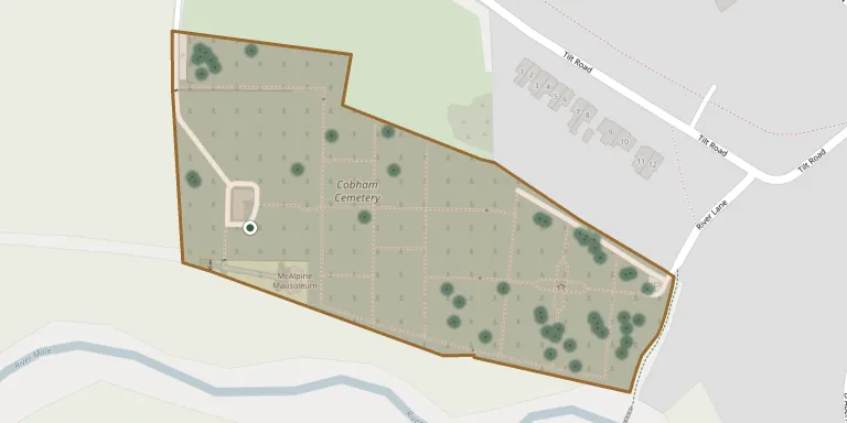
Cobham Cemetery was first opened in 1885 and lies about half a mile south-east of Church Cobham, on the Tilt. It originally belonged to Esher Urban Council and is now managed within Elmbridge Borough Council's cemeteries. War grave records for the site are held by the West Surrey Family History Society.
Cemetery location
GPS coordinates: 51.320400° N, 0.396400° W Directions in Google Maps (opens in a new tab)
Memorials
Showing the first 50 of 70, A–Z by surname. Search all records
 Frank Gostling 1913 – 2007
- Josephine Gostling 1917 – 2005
 Alma Grant 1920 – 2010
- William Grant 1921 – 2005
 Gretta Halsey 1942 – 2001
 Sheila Heney 1935 – 2007
 Agnes Hughes 1930 – 2007
- Raymond Hughes 1924 – 2013
 Barbara Ingram 1931 – 1988
 Helen James 1905 – 1994
 Peter Jones 1930 – 2011
 Johannes Klein 1929 – 1996
 Elizabeth Major 1925 – 2005
 William Mathews 1903 – 1989
 Ian Merritt 1968 – 2003
 Albert Miller 1904 – 1924
 Dorothy Mills 1905 – 1987
- William Mills 1902 – 1980
 Freda Nicholls 1907 – 1996
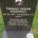 Thomas O'Donnell 1980 – 1997
 Francis O'Neill 1923 – 2003
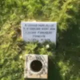 Julian Pawlyn 1979 – 1979
- Charles Phillips 1911 – 1944
- Ruby Phillips 1913 – 1987
- Gillian Pullin 1944 – 1993
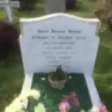 Hubert Ruddy 1897 – 1990
- Olga Ruddy 1922 – 2007
- Ethel Rushby 1890 – 1958
- Thomas Rushby 1880 – 1962
- Tony Rushby 1924 – 1989
 James Shearer 1918 – 1972
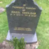 Hazel Sheridan 1931 – 2007
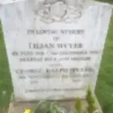 George Sivyer 1912 – 2004
- Lilian Sivyer 1910 – 1996
 Annie Steinart 1921 – 2004
- Eli Steinart 1918 – 2005
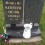 Kenneth Thomas 1933 – 1999
 Margaret Williams 1942 – 2007
 Duncan Wilson 1881 – 1935
 Mary Wimmer 1896 – 1985
 Beatrice Winchester 1902 – 1983
 George Winchester 1930 – 1944
 Harry Winchester 1869 – 1919
- Susan Winchester 1866 – 1952
 Gordon Winter 1933 – 2012
 Anna Winterborne 1859 – 1954
 Mary Winterborne 1923 – 2005
- Sid Winterborne 1912 – 2000
- William Winterborne 1844 – 1904
 Penny Witham 1938 – 2011
Looking for someone who isn't listed? Request a photo.
Nearby cemeteries
The closest other burial grounds listed on EveryStone.
- Cobham (St. Andrew) Churchyard 1.2 km away · Cobham
- Stoke D'Abernon (Saint Mary) Churchyard 1.3 km away · Stoke D'abernon · 4 records
- Hatchford Graveyard 2.8 km away · Hatchford
- Randalls Park Cemetery and Crematorium 3.9 km away · Mole Valley · 16 records
- Burvale Cemetery 4.7 km away · Hersham · 27 records
- St Mary Churchyard 4.7 km away · Mole Valley
- St Nicolas Parish Churchyard 4.8 km away · Mole Valley
- Hersham (Saint Peter) Churchyard 4.9 km away · Hersham · 2 records
- All Saints Church-Little Bookham 5.1 km away · Great Bookham · 13 records
- Our Lady Of Sorrows Catholic Church 5.2 km away · Effingham
Contribute with the app
Our website works smoothly on both desktop and mobile devices. Prefer a native app? Check it out below.
- Capture clear headstone photos
- Save GPS grave locations automatically
- Transcribe inscriptions with our AI
- Suggest corrections to existing records
Common questions
How big is Cobham Cemetery?
Cobham Cemetery covers about 26,000 m² (6.3 acres), about the size of 4 soccer fields. It is the 25th largest of the 219 cemeteries we list in Surrey.
What is the oldest grave in this cemetery?
The oldest grave among the records we hold for Cobham Cemetery is that of Frederic Froome Wood, who died on March 27, 1902 at the age of 13.