
Cemetery #238628
Arnold Burying Ground
0
documented records
≈ 4–9
approx. capacity (graves)
210 m²
cemetery area · 0.05 acres
Oct 18, 2026
last modified
About this cemetery
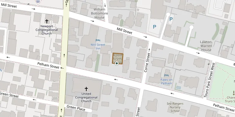
Arnold Burying Ground, also called the Governor Arnold Burying Ground, is a historic cemetery on Pelham Street just east of Spring Street in Newport, Rhode Island. It was established as a family cemetery by Governor Benedict Arnold, who also owned the land on which Newport's stone tower stands. The site was excavated and restored by Alice Brayton and John Howard Benson and presented to the Preservation Society of Newport County; fifty-three gravestones survive today.
Cemetery location
GPS coordinates: 41.486079° N, 71.312024° W Directions in Google Maps (opens in a new tab)
Memorials
No records yet
Photograph a headstone and add it to the archive.
Looking for someone who isn't listed? Request a photo.
Nearby cemeteries
The closest other burial grounds listed on EveryStone.
- Trinity Churchyard 140 m away · Newport
- Touro Cemetery 300 m away · Newport
- The Jewish Cemetery, Newport 340 m away · Newport
- Clifton Burying Ground 350 m away · Newport
- St. Josephs Cemetery 380 m away · Newport
- Coddington Burial Ground 730 m away · Newport
- Friends Cemetery 850 m away · Newport
- John Clarke Cemetery 860 m away · Newport
- Jonathan Easton Burial Ground 1.1 km away · Newport
- Common Burying Ground 1.1 km away · Newport
Contribute with the app
Our website works smoothly on both desktop and mobile devices. Prefer a native app? Check it out below.
- Capture clear headstone photos
- Save GPS grave locations automatically
- Transcribe inscriptions with our AI
- Suggest corrections to existing records
Common questions
How big is Arnold Burying Ground?
Arnold Burying Ground covers about 210 m², about the size of a tennis court. It is the 68th smallest of the 462 cemeteries we list in Rhode Island.