
Cemetery #24009
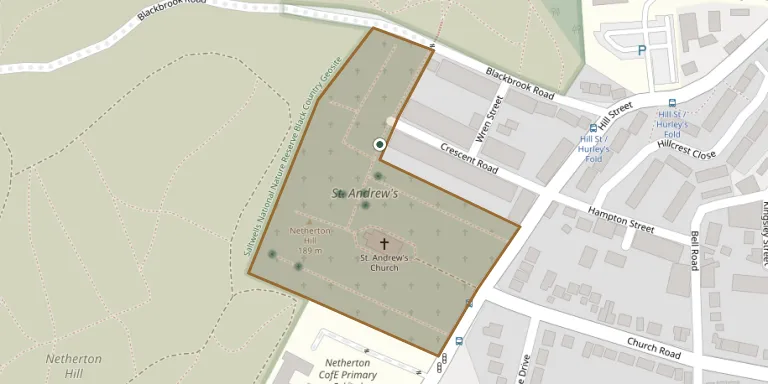
Netherton (Saint Andrew) Churchyard
Also known as St Andrew Church, Netherton · St. Andrew's Churchyard · St. Andrew's
16
documented records
≈ 640–1,300
approx. capacity (graves)
0.032 km²
cemetery area
Nov 5, 2026
last modified
About this cemetery
The churchyard belongs to St Andrew's, an Anglican parish church in Netherton, in the Metropolitan Borough of Dudley. The church was built for the Church Commissioners between 1827 and 1830 to designs by Thomas Lee, and stands at the highest point of Netherton. It is a Grade II listed building, and the churchyard contains Commonwealth war graves.
Cemetery location
GPS: GPS coordinates: 52.491570° N, 2.092540° W Directions in Google Maps (opens in a new tab)
Memorials
16 memorials, A–Z by last name.
 John Barnsley 1855 – 1934
- Sarah Barnsley ? – 1916
- Walter Barnsley ? – 1940
 Rebecca Evans 1835 – 1898
- William Evans 1829 – 1886
 Catherine Golding 1842 – 1902
- Henry Golding 1840 – 1914
- Harriett Gwilt ? – 1920
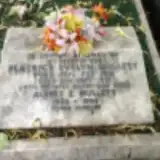 Albert Mullett 1903 – 1995
- Beatrice Mullett 1910 – 1981
 Rebecca Talbot ? – 1934
- Sallie Talbot ? – 1975
- Thomas Talbot 1891 – 1973
 Prudence While 1899 – 1957
 Doris Whitehouse 1902 – 2000
- John Whitehouse ? – 1957
Looking for someone who isn't listed? Request a photo.
Nearby cemeteries
The closest other burial grounds listed on EveryStone.
- Stourbridge Road Cemetery, Dudley 1.4 km away · Dudley
- Church of Saint Augustine of Hippo 1.4 km away · Dudley
- St Thomas and St Luke Churchyard 1.9 km away · Dudley
- Former King Street United Reformed Church Graveyard 2.0 km away · Dudley
- St Luke's Churchyard 2.2 km away · Cradley Heath · 41 records
- Christ Church Churchyard 2.3 km away · Dudley
- Kates Hill (Saint John) Churchyard 2.4 km away · Low Hill · 6 records
- The Parade Cemetery 2.4 km away · The Parade
- St Edmund King and Martyr Churchyard 2.4 km away · Dudley
- Former St. James' Cemetery 2.5 km away · Dudley
Contribute with the app
Our website works smoothly on both desktop and mobile devices. Prefer a native app? Check it out below.
- Capture clear headstone photos
- Save GPS grave locations automatically
- Transcribe inscriptions with our AI
- Suggest corrections to existing records
Common questions
How big is Netherton (Saint Andrew) Churchyard?
Netherton (Saint Andrew) Churchyard covers about 32,000 m² (7.9 acres), about the size of 4 soccer fields. It is the 43rd largest of the 174 cemeteries we list in West Midlands.
What is the oldest grave in this cemetery?
The oldest grave among the records we hold for Netherton (Saint Andrew) Churchyard is that of William Evans, who died on April 9, 1886 at the age of 57.