
0
documented records
≈ 31k–63k
approx. capacity (graves)
1.57 km²
cemetery area · 387.8 acres
Oct 18, 2026
last modified
About this cemetery
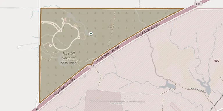
Fort Sill National Cemetery in Elgin, Comanche County, Oklahoma, was dedicated on November 2, 2001, on land originally part of the Fort Sill Military Reservation. It covers 391.3 acres and had more than 8,000 interments as of 2021. It is administered by the Department of Veterans Affairs.
Cemetery location
GPS coordinates: 34.764296° N, 98.343166° W Directions in Google Maps (opens in a new tab)
Memorials
No records yet
Photograph a headstone and add it to the archive.
Looking for someone who isn't listed? Request a photo.
Nearby cemeteries
The closest other burial grounds listed on EveryStone.
- Old Elgin Cemetery 5.6 km away · Elgin
- Otipoby Comanche Cemetery 6.2 km away · Ridley
- Saint Ann Cemetery 6.9 km away · Elgin
- Elgin Memorial Cemetery 7.4 km away · Elgin
- Beef Creek Apache Cemetery 7.9 km away · Fort Sill
- Bailtso Apache South Cemetery 8.1 km away · Fort Sill
- Fort Sill Mascot Cemetery 11 km away · White Wolf Bridge
- Fort Sill Post Cemetery 11 km away · Lawton
- Paradise Valley Cemetery 12 km away · Lawton
- Fletcher Cemetery 13 km away · Fletcher
Contribute with the app
Our website works smoothly on both desktop and mobile devices. Prefer a native app? Check it out below.
- Capture clear headstone photos
- Save GPS grave locations automatically
- Transcribe inscriptions with our AI
- Suggest corrections to existing records
Common questions
How big is Fort Sill National Cemetery?
Fort Sill National Cemetery covers about 157 hectares (388 acres), about the same size as Woodlawn Cemetery in the Bronx. It is the largest of the 2,711 cemeteries we list in Oklahoma.