
Cemetery #283855
Église Saint Rémy, Gerompont
Local name: Cimetière de Geest-Gérompont
Also known as Eglise Saint-Rémy de Gérompont · Geest Gérompont
12
documented records
≈ 42–84
approx. capacity (graves)
2,100 m²
cemetery area
Nov 6, 2026
last modified
About this cemetery
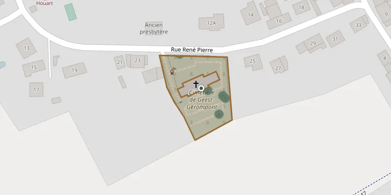
The communal cemetery of Gérompont, in the municipality of Ramillies, Walloon Brabant, is situated at the church of Saint-Rémy in Geest-Gérompont-Petit-Rosière. The cemetery can be found online through ramillies.be.
Cemetery location
GPS: GPS coordinates: 50.646944° N, 4.880655° E Directions in Google Maps (opens in a new tab)
Memorials
12 memorials, A–Z by surname.
 Julien Collon 1901 – 1975
- Juliette Collon 1902 – 1917
- Victor Collon 1871 – 1935
 Albert Goosen 1901 – 1942
 Oliva Leberger 1902 – 1985
- Marie L'Heureux 1866 – 1961
- Roger Losse 1896 – 1979
 Delvaux Tricot 1939 – 1984
- Noel Tricot 1906 – 1994
- Tricot 1903 – 1987
- Tricot ? – 1983
 Alice Vanhees 1908 – 1984
Looking for someone who isn't listed? Request a photo.
Nearby cemeteries
The closest other burial grounds listed on EveryStone.
- Mont Saint André Cemetery 1.4 km away · Ramillies · 8 records
- Église Saint Symphorien, Petit Rosière 1.4 km away · Ramillies · 9 records
- Mont Saint André Old Cemetery 1.5 km away · Ramillies · 17 records
- Ramillies-Offus Cemetery 2.0 km away · Ramillies · 7 records
- Grand-Rosière Cemetery 2.0 km away · Ramillies · 29 records
- Bomal Cemetery 2.4 km away · Ramillies · 1 record
- Ramillies Cemetery 2.8 km away · Ramillies
- Autre-Église Cemetery 3.6 km away · Ramillies · 23 records
- Noville sur Mehaigne Cemetery 3.9 km away · Éghezée
- Thorembais-les-Béguines Cemetery 4.4 km away · Perwez · 20 records
Contribute with the app
Our website works smoothly on both desktop and mobile devices. Prefer a native app? Check it out below.
- Capture clear headstone photos
- Save GPS grave locations automatically
- Transcribe inscriptions with our AI
- Suggest corrections to existing records
Common questions
How big is Église Saint Rémy, Gerompont?
Église Saint Rémy, Gerompont covers about 2,100 m² (0.5 acres), about the size of 8 tennis courts. It is the 58th smallest of the 175 cemeteries we list in Walloon Brabant.
What is the oldest grave in this cemetery?
The oldest grave among the records we hold for Église Saint Rémy, Gerompont is that of Juliette Collon, who died in 1917 at the age of 15.