
440
documented records
≈ 440–660
approx. capacity (graves)
0.012 km²
cemetery area
Oct 7, 2026
last modified
About this cemetery
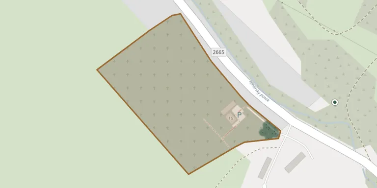
Tuhár Cemetery lies in Region of Banská Bystrica, Slovakia.
Cemetery location
GPS coordinates: 48.424837° N, 19.512022° E Directions in Google Maps (opens in a new tab)
Memorials
Showing the first 50 of 440, A–Z by surname. Search all records
 Tomáš Alač 1925 – 1946
 Ján Aláč 1910 – 1974
 Ján Aláč 1924 – 1974
 Jozef Aláč 1922 – 1997
 Jozef Aláč 1926 – 2008
 Jozef Aláč 1891 – 1971
 Jozef Aláč 1958 – 1990
 Jozef Aláč 1931 – 1963
 Juraj Aláč 1896 – 1981
 Pavel Aláč 1925 – 1982
 Pavel Aláč 1935 – 1992
- Anna Alačová 1892 – 1947
- Anna Aláčová 1928 – 2014
- Anna Aláčová 1911 – 1990
- Etela Aláčová 1931 – 2010
 Ivetka Aláčová 1960 – 1961
 Katarína Aláčová ? – 1960
 Katarína Aláčová 1898 – 1967
- Mária Aláčová 1928 – 1990
- Mária Aláčová 1899 – 1983
 Ružena Aláčová 1946 – 2009
 Zuzana Aláčová 1903 – 1967
 Zuzana Aláčová 1950 – 2014
 Alenka Bamburová 1971 – 2015
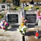 Ján Banaš 1890 – 1977
 Ján Banaš 1918 – 1987
 Ján Banaš 1912 – 1996
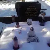 Ján Banaš 1939 – 2003
 Martin Banaš 1917 – 1964
 Martin Banaš 1893 – 1967
- Anna Banašová 1897 – 1972
- Anna Banašová 1912 – 2000
- Anna Banašová 1925 – 2014
- Anna Banašová 1940 – 2006
- Mária Banašová 1922 – 2005
- Mária Banašová 1898 – 1979
 Juraj Bez Údajov 1909 – 1964
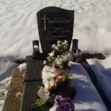 Božka Briestenská 1957 – 2013
 Vojtech Búš 1915 – 1971
- Anna Búšová 1920 – 1971
 Miroslav Cak 1956 – 1999
 Eugen Cako 1927 – 1989
 Ján Cako 1953 – 1979
 Mirko Cako 1978 – 2004
- Katarína Caková 1933 – 2014
 Ján Čeman ? – 1929
 Ján Čeman 1892 – 1995
 Ján Čeman 1933 – 2008
 Ján Čeman 1901 – 1974
 Ján Čeman 1909 – 1994
Looking for someone who isn't listed? Request a photo.
Nearby cemeteries
The closest other burial grounds listed on EveryStone.
- Divín Cemetery 2.7 km away · Divín · 12 records
- Divín Svätá Anna 2.9 km away · Divín
- Ružiná Cemetery 3.1 km away · Ružiná
- Budiná Cemetery 3.7 km away · Budiná
- Mýtna Cemetery 6.0 km away · Mýtna · 574 records
- Ábelová Cemetery 6.5 km away · Ábelová
- Praha Cemetery 7.0 km away · Praha
- Podrečany Cemetery 7.3 km away · Podrečany
- Lovinobaňa Municipal Cemetery 7.4 km away · Lovinobaňa
- Lentvora Cemetery 7.6 km away · Lentvora
Contribute with the app
Our website works smoothly on both desktop and mobile devices. Prefer a native app? Check it out below.
- Capture clear headstone photos
- Save GPS grave locations automatically
- Transcribe inscriptions with our AI
- Suggest corrections to existing records
Common questions
How big is Tuhár Cemetery?
Tuhár Cemetery covers about 12,000 m² (3.1 acres), about the size of 2 soccer fields. It is the 89th largest of the 557 cemeteries we list in Region of Banská Bystrica.
What is the oldest grave in this cemetery?
The oldest grave among the records we hold for Tuhár Cemetery is that of Anna Ufrlová, who died on March 30, 1928 at the age of 0.