
0
documented records
≈ 34–69
approx. capacity (graves)
1,720 m²
cemetery area
Oct 18, 2026
last modified
About this cemetery
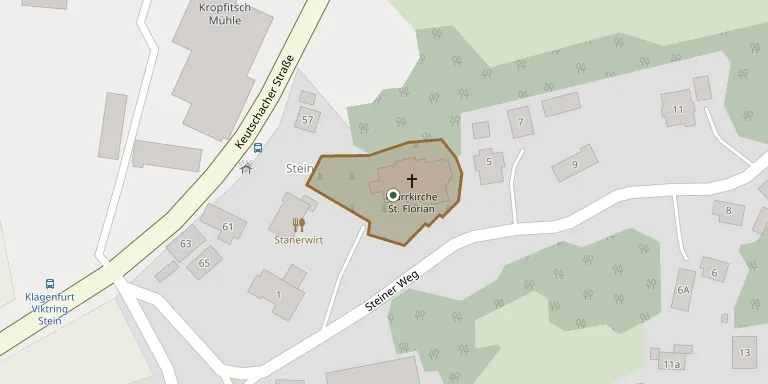
The site is the parish church of St. Florian in Stein, part of the 13th district of Viktring in Klagenfurt am Wörthersee, in the deanery of Klagenfurt-Stadt, Diocese of Gurk-Klagenfurt. The church and its former cemetery are protected monuments. An earlier church stood on the site before the present one.
Cemetery location
GPS coordinates: 46.594400° N, 14.286100° E Directions in Google Maps (opens in a new tab)
Memorials
No records yet
Photograph a headstone and add it to the archive.
Looking for someone who isn't listed? Request a photo.
Nearby cemeteries
The closest other burial grounds listed on EveryStone.
- Stein-Viktring Cemetery 260 m away · Viktring
- Friedensforst - Naturbestattung 2.5 km away · Klagenfurt am Wörthersee
- Sankt Martin Cemetery 2.7 km away · Klagenfurt
- St. Ruprecht Cemetery 2.8 km away · Klagenfurt am Wörthersee
- Klagenfurt am Wörthersee Jewish Cemetery 2.8 km away · Klagenfurt am Wörthersee
- Klagenfurt War Cemetery 2.8 km away · Stadt
- St. Martin Cemetery 3.3 km away · Klagenfurt am Wörthersee
- Paradies am Dom Cemetery, Innere Stadt 3.6 km away · Innere Stadt
- Maria Rain Cemetery 4.5 km away · Maria Rain
- Saint Peters Cemetery 5.3 km away · Stadt · 440 records
Contribute with the app
Our website works smoothly on both desktop and mobile devices. Prefer a native app? Check it out below.
- Capture clear headstone photos
- Save GPS grave locations automatically
- Transcribe inscriptions with our AI
- Suggest corrections to existing records
Common questions
How big is Florianikirche?
Florianikirche covers about 1,720 m² (0.4 acres), about the size of 7 tennis courts. It is the 216th smallest of the 442 cemeteries we list in Carinthia.