
0
documented records
≈ 59–120
approx. capacity (graves)
2,940 m²
cemetery area
Oct 18, 2026
last modified
About this cemetery
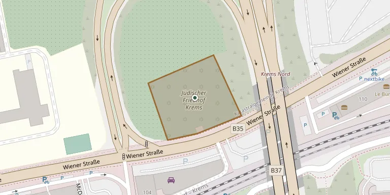
The Jewish cemetery in Krems was established in 1880/81 and became the main burial ground of the local community, replacing an older cemetery on the Turnerberg that had been desecrated several times between the wars. It covers nearly 3,000 square meters along Wiener Straße. A medieval Jewish burial ground in Krems is thought to have ended with the expulsion of 1421.
Cemetery location
GPS coordinates: 48.417356° N, 15.623919° E Directions in Google Maps (opens in a new tab)
Memorials
No records yet
Photograph a headstone and add it to the archive.
Looking for someone who isn't listed? Request a photo.
Nearby cemeteries
The closest other burial grounds listed on EveryStone.
- Krems an der Donau Cemetery 480 m away · Krems an der Donau
- Rohrendorf Cemetery 2.4 km away · Oberrohrendorf
- Gneixendorf Cemetery 2.8 km away · Krems an der Donau
- Stein an der Donau Cemetery 3.2 km away · Krems an der Donau
- Brunnkirchen Cemetery 3.4 km away · Brunnkirchen
- Rehberg Cemetery 3.5 km away · Imbach
- Stratzing Cemetery 4.1 km away · Stratzing
- Furth bei Göttweig Cemetery 4.5 km away · Furth bei Göttweig
- Gedersdorf Cemetery 4.6 km away · Gedersdorf
- Angern Cemetery 4.7 km away · Thallern
Contribute with the app
Our website works smoothly on both desktop and mobile devices. Prefer a native app? Check it out below.
- Capture clear headstone photos
- Save GPS grave locations automatically
- Transcribe inscriptions with our AI
- Suggest corrections to existing records
Common questions
How big is Krems Jewish Cemetery?
Krems Jewish Cemetery covers about 2,940 m² (0.7 acres), about the size of 11 tennis courts. It is the 501st largest of the 1,114 cemeteries we list in Lower Austria.