
0
documented records
≈ 16–32
approx. capacity (graves)
790 m²
cemetery area
Oct 18, 2026
last modified
About this cemetery
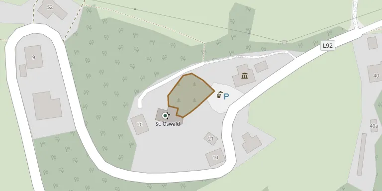
The parish church of St. Oswald ob Hornburg lies on the western slope of the Saualpe at about 1,020 metres. The church is first mentioned in 1369, dates from the 15th century and has a late Gothic chancel. At the cemetery there is a small memorial building with an open front, a crucifix and four stone tablets.
Cemetery location
GPS: 46.818600° N, 14.587000° E Directions in Google Maps (opens in a new tab)
Memorials
No records yet
Photograph a headstone and add it to the archive.
Looking for someone who isn't listed? Request a photo.
Nearby cemeteries
The closest other burial grounds listed on EveryStone.
- Eberstein Cemetery 2.1 km away · Eberstein
- Klein Sankt Paul Cemetery 4.0 km away · Klein Sankt Paul
- Sankt Walburgen Cemetery 6.2 km away · Sankt Walburgen
- Wieting Cemetery 6.8 km away · Wieting
- St. Martin am Krappfeld 7.5 km away · Sankt Klementen
- Pfarrkirche Kappel am Krappfeld 8.0 km away · Kappel am Krappfeld
- St.Klementen 8.1 km away · Sankt Klementen
- Pfarrkirche Silberegg 8.1 km away · Silberegg
- Brückl Cemetery 8.3 km away · Brückl
- Diex Fortified Churchyard 8.6 km away · Diex
Contribute with the app
Our website works smoothly on both desktop and mobile devices. Prefer a native app? Check it out below.
- Capture clear headstone photos
- Save GPS grave locations automatically
- Transcribe inscriptions with our AI
- Suggest corrections to existing records
Common questions
How big is Pfarrkirche St. Oswald ob Hornburg?
Pfarrkirche St. Oswald ob Hornburg covers about 790 m² (0.2 acres), about the size of 3 tennis courts. It is the 70th smallest of the 442 cemeteries we list in Carinthia.